Maps of Keweenaw County
Hancock
1 : 250000
Hancock
1 : 250000
Hancock
1 : 250000
Hancock
1 : 100000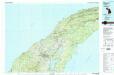
Hancock
1 : 100000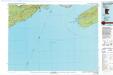
Grand Portage
1 : 100000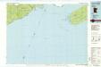
Grand Portage
1 : 100000
Siskiwit Bay
1 : 100000
Upper Peninsula, scale six miles to an inch, Isle Royale (and Keweenaw Co.)
1 : 380160 Walling, H. F.
Houghton
1 : 62500
Houghton
1 : 62500
Houghton
1 : 62500
Houghton
1 : 62500
Houghton
1 : 62500
Grand Portage
1 : 62500
Grand Portage
1 : 62500
Manitou Island
1 : 24000
Manitou Island
1 : 24000
Manitou Island
1 : 24000
Manitou Island
1 : 24000
Chassell
1 : 24000
Point Mills
1 : 24000
Rockhouse Point
1 : 24000
Rockhouse Point
1 : 24000
Graveraet River
1 : 24000
Point Mills
1 : 24000
Point Mills
1 : 24000
Traverse Island
1 : 24000
Point Mills
1 : 24000
Traverse Island
1 : 24000
South Range
1 : 24000
Chassell
1 : 24000
Chassell
1 : 24000

