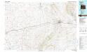
Maps of Rawlins

Maps of Rawlins

$title$

Rawlins

1 : 100000
$title$

Bridger Pass

1 : 62500
$title$

Bridger Pass

1 : 62500
$title$

Bolten Ranch

1 : 62500
$title$

Bolten Ranch

1 : 62500
$title$

Rawlins Peak

1 : 62500
$title$

Bridger Pass

1 : 24000
$title$

La Marsh Creek West

1 : 24000
$title$

Bridger Pass

1 : 24000
$title$

La Marsh Creek East

1 : 24000
$title$

Kindt Reservoir

1 : 24000
$title$

Eightmile Lake

1 : 24000
$title$

Eightmile Lake

1 : 24000
$title$

High Point

1 : 24000
$title$

High Point

1 : 24000
$title$

Seaverson Reservoir

1 : 24000
$title$

Seaverson Reservoir

1 : 24000
$title$

Fillmore Ranch

1 : 24000
$title$

Fillmore Ranch

1 : 24000
$title$

Separation Peak

1 : 24000
$title$

Coal Mine Ridge

1 : 24000
$title$

Smith Draw West

1 : 24000
$title$

Smith Draw East

1 : 24000
$title$

Wamsutter

1 : 24000
$title$

Wamsutter

1 : 24000
$title$

Wamsutter

1 : 24000
$title$

Creston

1 : 24000
$title$

Creston

1 : 24000
$title$

Creston Junction

1 : 24000
$title$

Creston Junction

1 : 24000
$title$

Riner

1 : 24000
$title$

Riner

1 : 24000
© MapTiler © OpenStreetMap contributors
How does it work?
These instructions will show you how to find historical maps online.
Getting started
Type the place name in the search box to find the exact location. You can further adjust the search by zooming in and out.
Zoom
Zoom in and out with the buttons or use your mouse or touchpad natively.
Exact Area tool
Click here and draw a rectangle over the map to precisely define the search area.
Set filters
Narrow your search with advanced settings, such as Years (from/to), Fulltext, Publisher, etc.
Results
See the results of your search on the right side. You can scroll down to find more maps of this location.
?

Download OldMapsOnline Mobile