Maps of Charles Mix County
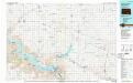
Lake Andes
1 : 100000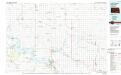
Lake Andes
1 : 100000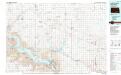
Lake Andes
1 : 100000
Avon
1 : 24000
Lake Andes SW
1 : 24000
Fort Randall Dam
1 : 24000
Dante
1 : 24000
Bonesteel
1 : 24000
South Scalp Creek
1 : 24000
Fort Randall Dam
1 : 24000
Lake Andes SW
1 : 24000
Wagner SW
1 : 24000
Wagner
1 : 24000
Wagner
1 : 24000
Greenwood Colony
1 : 24000
Oak Hollow
1 : 24000
Lake Andes
1 : 24000
Lake Andes NW
1 : 24000
Whetstone Bay
1 : 24000
Campbell Creek
1 : 24000
Lake Andes NW
1 : 24000
Lake Andes NW
1 : 24000
Lake Andes
1 : 24000
Lake Andes
1 : 24000
Ravinia
1 : 24000
Ravinia
1 : 24000
Wagner NE
1 : 24000
Castalia
1 : 24000
Bovee
1 : 24000
Armour SW
1 : 24000
Armour
1 : 24000
Delmont
1 : 24000

