Maps of Brule County
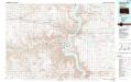
Chamberlain
1 : 100000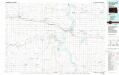
Chamberlain
1 : 100000
Iona
1 : 62500
Iona
1 : 62500
Iona
1 : 62500
Pukwana
1 : 62500
Pukwana
1 : 62500
Chamberlain
1 : 62500
Chamberlain
1 : 62500
Chamberlain
1 : 62500
Bijou Hills
1 : 24000
Eagle
1 : 24000
Iona
1 : 24000
Bond Bottom
1 : 24000
Hamill
1 : 24000
Hamill SE
1 : 24000
Hamill
1 : 24000
Ideal NE
1 : 24000
Ideal NE
1 : 24000
Red Lake East
1 : 24000
Bijou Hills NE
1 : 24000
Red Lake West
1 : 24000
Hamill NW
1 : 24000
Hamill NW
1 : 24000
Hamill NE
1 : 24000
Iona NW
1 : 24000
Iona NW
1 : 24000
Ideal NW
1 : 24000
Kennebec SE
1 : 24000
Pukwana
1 : 24000
Pukwana SE
1 : 24000
Kennebec SW
1 : 24000
Chamberlain
1 : 24000
Reliance SW
1 : 24000
Reliance SE
1 : 24000

