Maps of Pershing County
Eugene Mts
1 : 100000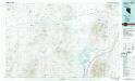
Eugene Mts
1 : 100000
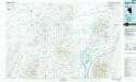
Imlay
1 : 62500
Imlay
1 : 62500
Imlay
1 : 62500
Eugene Mountains Area
1 : 62500
Eugene Mountains Area
1 : 62500
Eugene Mountains Area
1 : 62500
Eugene Mountains Area
1 : 62500
Star Peak
1 : 24000
Juniper Canyon
1 : 24000
Rocky Canyon
1 : 24000
Dead Horse Canyon
1 : 24000
Imlay
1 : 24000
Mill City
1 : 24000
Sheep Spring
1 : 24000
Dead Horse Canyon NE
1 : 24000
Dead Horse Canyon NE
1 : 24000
Scossa
1 : 24000
Majuba Mtn
1 : 24000
Rye Patch Reservoir North
1 : 24000
Woody Canyon
1 : 24000
Cosgrave
1 : 24000
Cholona
1 : 24000
Rabbithole
1 : 24000
Sawtooth Knob
1 : 24000
Sulphur
1 : 24000
Long Canyon
1 : 24000
Alpha Mountain
1 : 24000
Floka
1 : 24000
Gaskell
1 : 24000
Pronto
1 : 24000
Black Rock Point East
1 : 24000
Rabbithole NE
1 : 24000

