Maps of Thayer County

Hebron
1 : 125000
Hebron
1 : 125000
Thayer Co.
1 : 126720 Everts & Kirk
Byron
1 : 24000
Hebron SW
1 : 24000
Chester
1 : 24000
Ruskin
1 : 24000
Deshler
1 : 24000
Deshler
1 : 24000
Davenport
1 : 24000
Edgar
1 : 24000
Bruning
1 : 24000
Edgar NW
1 : 24000
Ong
1 : 24000
Shickley
1 : 24000
Shickley
1 : 24000
Strang
1 : 24000
Fairbury
1 : 100000
Fairbury
1 : 100000
Nuckolls County.
1 : 126720 Everts & Kirk
Fillmore Co.
1 : 126720 Everts & Kirk
Lincoln
1 : 250000
Lincoln
1 : 250000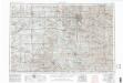
Lincoln
1 : 250000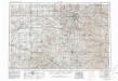
Lincoln
1 : 250000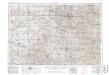
Lincoln
1 : 250000
Clay Co.
1 : 126720 Everts & Kirk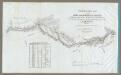
Map Of The Road From Missouri To Oregon ... Section I.
1 : 633600 Preuss, Charles
Campaign map of the department of the Platte. sheet no. 1 : comprising that portion of Nebraska
1 : 600000 Jones, William Albert 1841-1914; États-Unis. Corps of Engineers [Omaha, Nebr.] : Engineer Dept., U.S. Army

