Maps of Cherry County
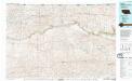
Cody
1 : 100000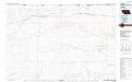
Cody
1 : 100000
Doughboy
1 : 62500
Gypsy Valley
1 : 62500
Merriman 4
1 : 62500
Doughboy
1 : 62500
Powderhorn Valley
1 : 62500
Eli
1 : 62500
Irwin
1 : 62500
Merriman
1 : 62500
Merriman
1 : 62500
Irwin
1 : 62500
Cody
1 : 62500
Wild Mare Lake SW
1 : 24000
North Valley
1 : 24000
Farm Flat
1 : 24000
Indian Hill
1 : 24000
Powderhorn Valley SW
1 : 24000
Chesterfield Flats
1 : 24000
Pole Creek Valley
1 : 24000
Bornemann Lake
1 : 24000
Wild Mare Lake
1 : 24000
Medicine Lake
1 : 24000
Heath Valley
1 : 24000
Spring Lake
1 : 24000
Irwin SW
1 : 24000
Merriman SW
1 : 24000
Merriman SE
1 : 24000
Eli SE
1 : 24000
Eli SW
1 : 24000
Spring Canyon
1 : 24000

