Maps of Burt County
Blair
1 : 100000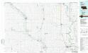
Blair
1 : 100000
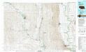
Burt County, Neb.
1 : 105600 Everts & Kirk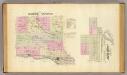
Dodge County.
1 : 126720 Everts & Kirk
Cuming County.
1 : 126720 Everts & Co.
Blair
1 : 24000
Modale
1 : 24000
Blair
1 : 24000
Orum
1 : 24000
Dodge SW
1 : 24000
Webster
1 : 24000
Scribner SW
1 : 24000
Nickerson
1 : 24000
Nickerson NE
1 : 24000
Herman
1 : 24000
Mondamin
1 : 24000
Snyder
1 : 24000
Scribner
1 : 24000
Uehling
1 : 24000
Nickerson NW
1 : 24000
Craig
1 : 24000
Tekamah
1 : 24000
Little Sioux
1 : 24000
Tekamah
1 : 24000
Monterey
1 : 24000
Oakland
1 : 24000
West Point SE
1 : 24000
Bertha
1 : 24000
Blencoe
1 : 24000
Tekamah NW
1 : 24000
West Point NW
1 : 24000
West Point NE
1 : 24000
Lyons
1 : 24000

