Maps of Yuma County
Tinajas Altas Mts
1 : 100000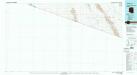
Tinajas Altas Mts
1 : 100000
Vopoki Ridge
1 : 62500
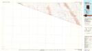
Tinajas Altas
1 : 62500
Tinajas Altas
1 : 62500
South of Yuma
1 : 62500
Tinajas Altas
1 : 24000
Vopoki Ridge SE
1 : 24000
Tinajas Altas
1 : 24000
Butler Mountains
1 : 24000
Raven Butte
1 : 24000
South of Somerton
1 : 24000
Southeast of Somerton
1 : 24000
West of Vopoki Ridge
1 : 24000
Vopoki Ridge
1 : 24000
Raven Butte
1 : 24000
Cipriano Pass
1 : 24000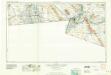
El Centro
1 : 250000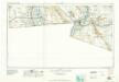
El Centro
1 : 250000
El Centro
1 : 250000
El Centro
1 : 250000
El Centro
1 : 250000
El Centro
1 : 250000
Plan De L'Embouchure Du Rio Colorado.
Duflot de Mofras, Eugene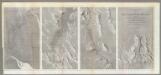
Rio Colorado of the West.
1 : 380160 Ives, J.C.
Geological Map ... Rio Colorado of the West.
1 : 380160 Ives, J.C.
Gadsden
1 : 24000
Gadsden
1 : 24000
Map No. 2 of the El Paso & Fort Yuma Wagon Road.
1 : 6000000 Campbell, Albert

