Maps of Humboldt County

Dinsmore
1 : 24000
Dinsmore
1 : 24000
Dinsmore
1 : 24000
Blocksburg
1 : 62500
Blocksburg
1 : 62500
Blocksburg
1 : 62500
Garberville
1 : 100000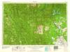
Redding
1 : 250000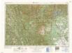
Redding
1 : 250000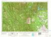
Redding
1 : 250000
Redding
1 : 250000
Trinity County, California.
1 : 126720 Johnson, Jno. F.
Northern California.
1 : 2150000 Holdredge, Sterling M.
San Francisco Bay to N. boundary of California.
1 : 760320 Williamson, R.S.
Lower Oregon and Upper California.
1 : 1077120 Tennent, Thomas
California, Nevada (NW)
1 : 633600 United States. Post Office Dept.
California, Nevada (NW)
1 : 633600 United States. Post Office Dept.
Irrigation map of southern California.
1 : 506880 U.S. Dept. of Agriculture, Bureau of Public Roads, Irrigation Investigations.|~|"Revised and redrawn 1920 in cooperation with California State Dept. of Engineering; College of Agriculture, University of California; California State Water Commission."|~|Covers the area from Owens Lake over to Santa Barbara County, south to the Mexican border.|~|Includes location map and inset of Owens Valley.|~|Relief represented by shading.|~|Shows agricultural areas, irrigated areas, irrigation canals, boundaries of irrigation districts, principal hydroelectric plants, U.S. Geological Survey and private stream gauging stations, and rainfall stations.|~|UCLA Catalog Record United States. Bureau of Public Roads. The Bureau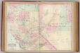
Calif., Nev. north.
1 : 1267200 Asher & Adams
California and Nevada. North Portion.
1 : 1290000 Asher & Adams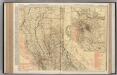
California (Northern Section).
1 : 1140000 Rand McNally and Company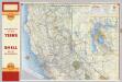
Shell Highway Map of California (northern portion).
1 : 1330560 Shell Oil Company
Cote NO, l'Amerique 2.
1 : 1500000 Vancouver, George, 1757-1798
The Coast of N.W. America
1 : 1400000 Vancouver, George, 1757-1798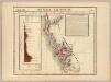
Nouvelle Californie. Amer. Sep. 46.
1 : 1641836 Vandermaelen, Philippe, 1795-1869
Map of California Roads for Cyclers.
1 : 1203840 Blum, George W.
Map of northern California showing general plan for the reclamation of the entire Sacramento and San Joaquin Valleys
1 : 11450000 Brown line print. Shows which areas are to be irrigated by which specific rivers. "Map A" Marshall, R. B. (Robert Bradford). 1867-1949. [S.N.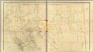
California, Nevada (upper)
1 : 696960 Von Haake, A.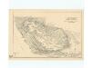
Panoramic perspective of Central Valley Project of California
Covers California from the Oregon border to the Mohave Desert. Relief shown pictorially and by spot heights.Shows canals, power transmission lines, pumping plants, dams, etc. United States. Bureau of Reclamation, A A Abel [Washington, D.C.] : U.S. Dept. of the Interior, Bureau of Reclamation.

