Maps of Santa Barbara County

Tepusquet Peak
1 : 62500
Tepusquet Peak
1 : 62500
Tepusquet Peak
1 : 62500
Foxen Canyon
1 : 24000
Zaca Lake
1 : 24000
Foxen Canyon
1 : 24000
Foxen Canyon
1 : 24000
Zaca Lake
1 : 24000
Zaca Lake
1 : 24000
Zaca Lake
1 : 24000
Tepusquet Canyon
1 : 24000
Manzanita Mountain
1 : 24000
Tepusquet Canyon
1 : 24000
Tepusquet Canyon
1 : 24000
Manzanita Mtn
1 : 24000
Manzanita Mtn
1 : 24000
Lompoc
1 : 125000
Lompoc
1 : 125000
Lompoc
1 : 125000
Lompoc
1 : 125000
Lompoc
1 : 125000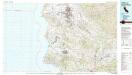
Santa Maria
1 : 100000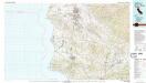
Santa Maria
1 : 100000
[Santa Barbara County]
Kalifornie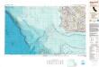
Santa Maria
1 : 250000
Santa Maria
1 : 250000
Santa Maria
1 : 250000
Santa Maria
1 : 250000
Santa Maria
1 : 250000
Santa Maria
1 : 250000
Santa Maria
1 : 250000

