Maps of Cavalier County
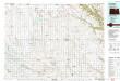
Langdon
1 : 100000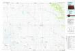
Langdon
1 : 100000
Billings Lake
1 : 24000
Nekoma
1 : 24000
Osnabrock SW
1 : 24000
Waterloo Lake
1 : 24000
Munich SW
1 : 24000
Munich SE
1 : 24000
Hampden
1 : 24000
Hampden
1 : 24000
Nekoma NW
1 : 24000
Easby
1 : 24000
Milton
1 : 24000
Calio
1 : 24000
Munich
1 : 24000
Loma
1 : 24000
Alsen
1 : 24000
Olga
1 : 24000
Hannah SW
1 : 24000
Hannah SE
1 : 24000
Langdon West
1 : 24000
Langdon West
1 : 24000
Olga SW
1 : 24000
Langdon East
1 : 24000
Langdon East
1 : 24000
Sarles
1 : 24000
Sarles NE
1 : 24000
Wales
1 : 24000
Hannah
1 : 24000
Mount Carmel
1 : 24000

