Maps of Pawnee County

Lela
1 : 24000
Pawnee
1 : 62500
Pawnee
1 : 62500
Pawnee
1 : 62500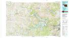
Keystone Lake
1 : 100000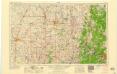
Enid
1 : 250000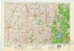
Enid
1 : 250000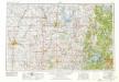
Enid
1 : 250000
Enid
1 : 250000
Enid
1 : 250000
Gen. map XXV.
1 : 633600 United States. War Department
Plate CXLII. Map of Indian Territory, Showing Distribution of Woodland, Compiled under the Direction of C.H. Fitch by Gilbert Thompson, F.E. Matthes and M.L. Cudlipp. 1899.
1 : 500000 Walcott, Charles D.
Indian Territory : [Oklahoma] / surveyed under the dir. of Charles H. Fitch
1 : 500000 Annotatie geografische gegevens: Opname: 1895-1899 Fitch, Charles H. [Washington, D.C. : U.S. Geological Survey]
A map of the Indian Territory, northern Texas and New Mexico
1 : 3500000 Breese, S.
Indian Territory.
1 : 1400000 Mitchell, Samuel Augustus
Indian Territory.
1 : 1400000 Mitchell, Samuel Augustus
Indian Territory.
1 : 1400000 Mitchell, Samuel Augustus Jr.
Indian Terr.
1 : 1500000 Mitchell, Samuel Augustus
Indian Territory.
1 : 760320 U.S. General Land Office
Indian Territory
1 : 1526640 Colton, G.W.
Indian Territory.
1 : 1526640 Colton, G.W.
Oklahoma.
1 : 2100000 Cram, George Franklin
Oklahoma.
Rand McNally and Company
Post route map of the states of Kansas and Nebraska : showing post offices with the intermediate distances and mail routes in operation on the 1st of December, 1900 / published by order of Postmaster General Charles Emory Smith under the direction of ...
From Parts
Indian Territory, Oklahoma.
1 : 1300000 Rand McNally and Company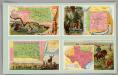
Indian Territory, New Mexico, South Dakota, Texas.
Arbuckle Bros.
From mouth of Trap Creek to Santa Fe Crossing.
1 : 760320 Gunnison, J.W.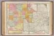
Oklahoma and Indian Territory.
1 : 824000 Rand McNally and Company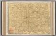
Oklahoma.
1 : 824000 Rand McNally and Company

