Cataloged map
Norwich


Full title:Norwich
Depicted:1986
Pubdate:1993
Physical Size:20 x 30 cm
Map scale:1:100 000
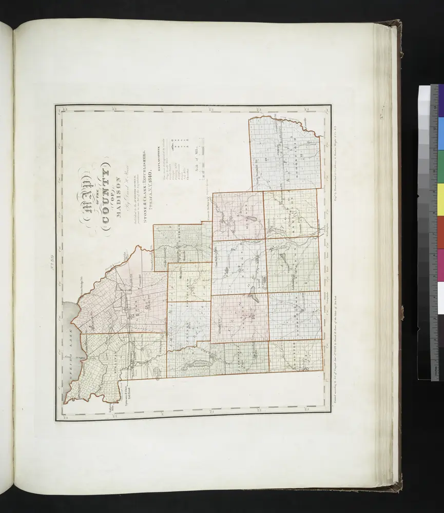
Map of the county of Madison / by David H. Burr; engd. by Rawdon, Clark & Co., Albany, & Rawdon, Wright & Co., N.Y.; An atlas of the state of New York: containing a map of the state and of the several counties / by David H. Burr.
1841
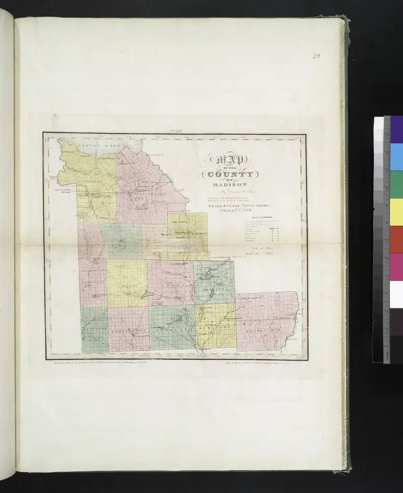
Map of the county of Madison / by David H. Burr; engd. by Rawdon, Clark & Co., Albany, & Rawdon, Wright & Co., N.Y.; An atlas of the state of New York, designed for the use of engineers, containing a map of the state and of the several counties. / Projected and drawn ... under the superintendence and direction of Simeon de Witt.
1839
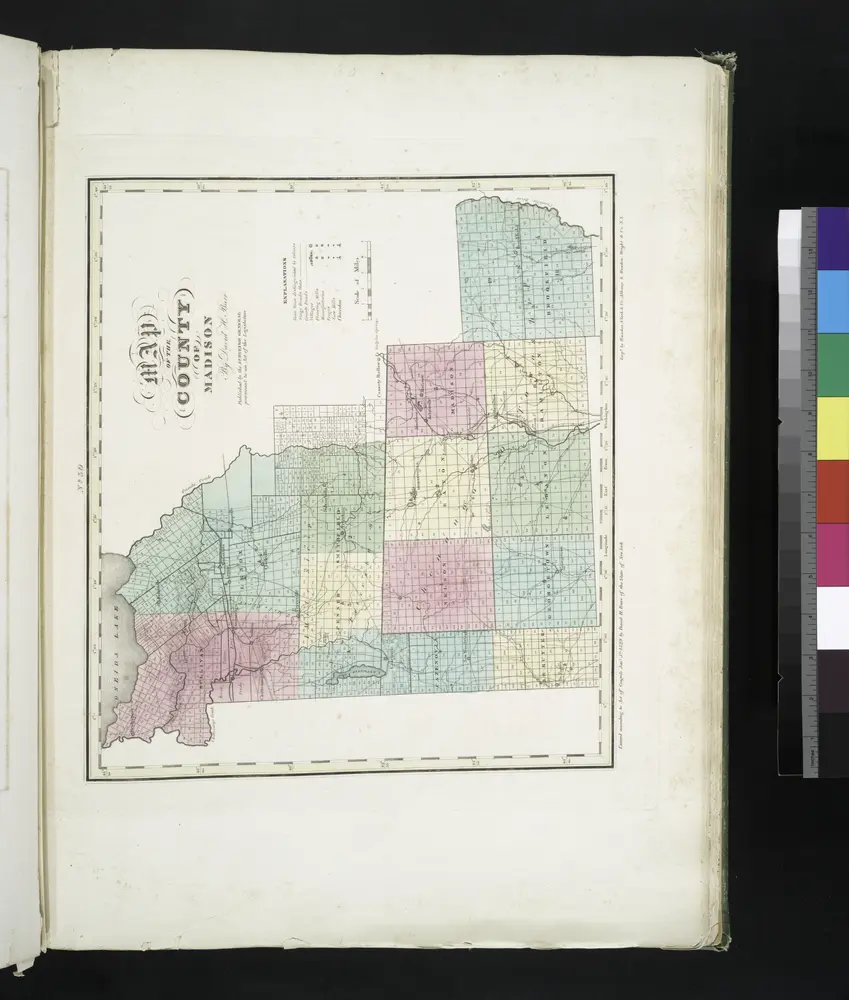
Map of the county of Madison / by David H. Burr; engd. by Rawdon, Clark & Co., Albany, & Rawdon, Wright & Co., N.Y.; An atlas of the state of New York: containing a map of the state and of the several counties. / Projected and drawn under the superintendence and direction of Simeon de Witt ... And also the physical geography of the State ...
1829
Sangerfield
1943
1:63k
Sangerfield
1907
1:63k
Sangerfield
1907
1:63k
Sangerfield
1907
1:63k
Sangerfield
1907
1:63k
Sangerfield
1907
1:63k
Sangerfield
1907
1:63k
Morrisville
1902
1:63k
Morrisville
1902
1:63k
Morrisville
1902
1:63k
Morrisville
1902
1:63k
Morrisville
1902
1:63k
Morrisville
1902
1:63k
Morrisville
1902
1:63k
Morrisville
1902
1:63k