Maps of Franklin County

Loon Lake
1 : 62500
Loon Lake
1 : 62500
Loon Lake
1 : 62500
Loon Lake
1 : 62500
Loon Lake
1 : 62500
Loon Lake
1 : 62500
Loon Lake
1 : 62500
Loon Lake
1 : 62500
Debar Mountain
1 : 24000
Debar Mountain
1 : 24000
Debar Mountain
1 : 24000
Loon Lake
1 : 24000
Loon Lake
1 : 24000
Owls Head
1 : 24000
Owls Head
1 : 24000
Owls Head
1 : 24000
Ragged Lake
1 : 24000
Ragged Lake
1 : 24000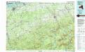
Massena
1 : 100000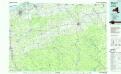
Massena
1 : 100000
Franklin County.
1 : 158400 Bien, Joseph Rudolf
Franklin County.
1 : 151000 Burr, David H., 1803-1875
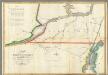
Malone [Township]
from Atlas of Franklin County, New York. : From actual surveys and official records.
Outline plan of Franklin Co.
from Atlas of Franklin County, New York. : From actual surveys and official records.
Ogdensburg
1 : 250000
Ogdensburg
1 : 250000
Ogdensburg
1 : 250000
Ogdensburg
1 : 250000
Ogdensburg
1 : 250000