Cataloged map
White Plains


Full title:White Plains
Depicted:1967
Pubdate:1969
Physical Size:20 x 30 cm
Map scale:1:24 000
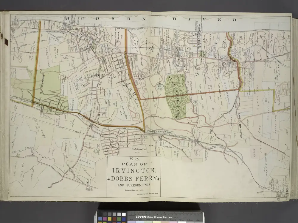
Plan of Irvington, Dobbs Ferry and Surroundings.
1891
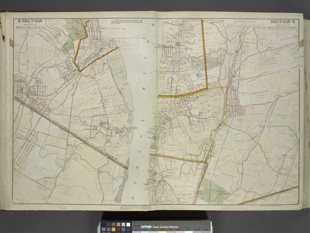
Portion of Rockland County. ; Portion of Westchester County.
1891
White Plains
1967
1:24k
White Plains
1967
1:24k
White Plains
1967
1:24k
White Plains
1957
1:24k
White Plains
1957
1:24k
White Plains
1947
1:24k
White Plains
1938
1:32k
White Plains
1938
1:32k
White Plains
1932
1:24k