Maps of Rockland County

Thiells
1 : 24000
Thiells
1 : 24000
Thiells
1 : 24000
Thiells
1 : 24000
Ramapo
1 : 62500
Ramapo
1 : 62500
Ramapo
1 : 62500
Ramapo
1 : 62500
Ramapo
1 : 48000
Ramapo
1 : 62500
Ramapo
1 : 62500
Ramapo
1 : 62500
Ramapo
1 : 62500
Ramapo
1 : 62500
Ramapo
1 : 62500
Ramapo
1 : 62500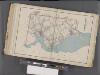
Westchester, Double Page Plate No. 25 [Map of Town of Cortlandt] / prepared under the direction of Joseph R. Bien, from general surveys and official records.
From Atlas of Westchester County, New York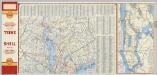
(Metropolitan New York and Long Island) Northern Section. To and Through Manhattan.
Shell Oil Company
Ulster, Orange counties.
1 : 158400 Bien, Joseph Rudolf
Crugers Sta,. Boscobel P.O.
from County atlas of Westchester, New York. Published by J.B. Beers & Co., assisted by S.W. Wilson and others.
The Hudson by daylight map, from New York Bay to the head of tide water : containing names of streams, islands, and heights of mountains according to the latest coast survey : also the names of prominent residences, historic land marks, the old reaches o
from Hudson River
Westchester County.
1 : 151000 Burr, David H., 1803-1875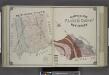
Geological Map of Passaic County, New Jersey.
from Atlas of Passaic County, New-Jersey : topographical, geological, historical, illustrated ; from actual surveys of each township and village / under the supervision of the publishers, assisted by the able engineers of Paterson.
A plan of the operations of the King's army under the command of General Sr. William Howe, K.B. in New York and east New Jersey against the American forces commanded by General Washington from the 12th. of October, to the 28th. of November 1776 ...
1 : 88000 Sauthier, Claude Joseph Stedman, Charles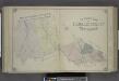
Outline Map of Passaic County, New Jersey.
from Atlas of Passaic County, New-Jersey : topographical, geological, historical, illustrated ; from actual surveys of each township and village / under the supervision of the publishers, assisted by the able engineers of Paterson.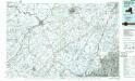
Middletown
1 : 100000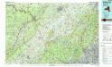
Middletown
1 : 100000
New jersey
Baker, Harriet E.
[Rockland County].
from Atlas of New York.

