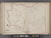
Maps of West Nyack

Nyack
1 : 24000
Nyack
1 : 24000
Nyack
1 : 24000
Nyack
1 : 24000
Nyack
1 : 24000
Nyack
1 : 31680
Nyack
1 : 31680
Nyack
1 : 31680
Nyack
1 : 24000
Nyack
1 : 24000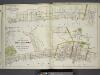
Plan of Grand View, Rockland County, N.Y. ; Plans of Nyack, South Nyack and part of Piermont, Rockland County, N.Y.
from Atlas of the Hudson River Valley from New York city to Troy, including a section of about 8 miles in width. Published by Watson & co. Compiled from official records and careful surveys, under the supervision of F. W. Beers.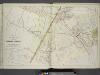
Plans of Parts of Piermont, Sparkill, and Palisades, N.Y. and Harrington, N.J.
from Atlas of the Hudson River Valley from New York city to Troy, including a section of about 8 miles in width. Published by Watson & co. Compiled from official records and careful surveys, under the supervision of F. W. Beers.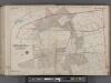
Bergen County, V. 1, Double Page Plate No. 27 [Parts of the boroughs of Harrington Park, Norwood TWP. of Harrington] / by George W. and Walter S. Bromley.
From V. 1, 1912.
Tarrytown
1 : 62500
Tarrytown
1 : 62500
Tarrytown
1 : 62500
Tarrytown
1 : 62500
Tarrytown
1 : 62500
Tarrytown
1 : 62500
Tarrytown
1 : 62500
Tarrytown
1 : 62500
Tarrytown
1 : 62500
Tarrytown
1 : 62500
4. Yonkers-Tarrytown-Hartsdale.
1 : 80000 Servoss, R. D.
4. Yonkers-Tarrytown-Hartsdale.
1 : 80000 Servoss, R. D.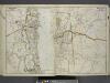
Portion of Rockland County. ; Portion of Westchester County.
from Atlas of the Hudson River Valley from New York city to Troy, including a section of about 8 miles in width. Published by Watson & co. Compiled from official records and careful surveys, under the supervision of F. W. Beers.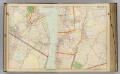
6 Rockland, Westchester counties.
1 : 14400 Watson & Co. (New York, N.Y.)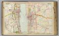
7 Rockland, Westchester counties.
1 : 14400 Watson & Co. (New York, N.Y.)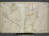
Portion of Rockland County. ; Portion of Westchester County.
from Atlas of the Hudson River Valley from New York city to Troy, including a section of about 8 miles in width. Published by Watson & co. Compiled from official records and careful surveys, under the supervision of F. W. Beers.