Maps of Saratoga County

Conklingville
1 : 24000
Conklingville
1 : 24000
Hadley [Township]; Hadley Business Directory.
from New topographical atlas of Saratoga Co., New York, from actual surveys by S. N. & D. G. Beers and assistants.
Lake Luzerne
1 : 62500
Lake Luzerne
1 : 62500
Lake Luzerne
1 : 62500
Lake Luzerne
1 : 62500
Luzerne
1 : 62500
Luzerne
1 : 62500
Luzerne
1 : 62500
Luzerne
1 : 62500
Luzerne
1 : 62500
Luzerne
1 : 62500
Luzerne
1 : 62500
Luzerne
1 : 62500
Day Corners Business Directory. ; Huntsville Business Directory. ; Day [Township]
from New topographical atlas of Saratoga Co., New York, from actual surveys by S. N. & D. G. Beers and assistants.
Corinth [Township]; Palmer Falls Business Directory.
from New topographical atlas of Saratoga Co., New York, from actual surveys by S. N. & D. G. Beers and assistants.
Edinburgh [Township]
from New topographical atlas of Saratoga Co., New York, from actual surveys by S. N. & D. G. Beers and assistants.
Saratoga County.
1 : 151000 Burr, David H., 1803-1875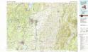
Glens Falls
1 : 100000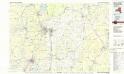
Glens Falls
1 : 100000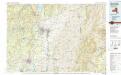
Glens Falls
1 : 100000
Warren County.
1 : 151000 Burr, David H., 1803-1875
Map of Saratoga County
from New topographical atlas of Saratoga Co., New York, from actual surveys by S. N. & D. G. Beers and assistants.
Map of the county of Saratoga / by David H. Burr ; engd. by Rawdon, Clark & Co., Albany, & Rawdon, Wright & Co., N. York.
from An atlas of the state of New York : containing a map of the state and of the several counties / by David H. Burr.
A prospective plan of the battle fought near Lake George on the 8th of September, 1755 between 2000 English with 250 Mohawks under the command of General Johnson and 2500 French and Indians under the command of General Dieskau ...
Blodget, Samuel
Warren, Saratoga, Washington counties.
1 : 158400 Bien, Joseph Rudolf
Map of the county of Montgomery and Fulton / by David H. Burr ; engd. by Rawdon, Clark & Co., Alby., & Rawdon, Wright & Co., N. York.
from An atlas of the state of New York : containing a map of the state and of the several counties / by David H. Burr.
Map of the county of Saratoga / by David H. Burr ; engd. by Rawdon, Clark & Co., Albany, & Rawdon, Wright & Co., N. York.
from An atlas of the state of New York : containing a map of the state and of the several counties. / Projected and drawn under the superintendence and direction of Simeon de Witt ... And also the physical geography of the State ...

