Maps of Marquette County

Champion
1 : 62500
Champion
1 : 62500
Champion
1 : 62500
Champion
1 : 24000
Champion
1 : 24000
Champion
1 : 24000
Diorite
1 : 24000
Diorite
1 : 24000
Silver Lake Basin
1 : 24000
Bulldog Lake
1 : 24000
Silver Lake Basin
1 : 24000
Atlas to accompany monograph XXVIII on the Marquette iron-bearing district of Michigan
1 : 630000 Sheet 15 Van Hise, Charles Richard United States Geological Survey
Atlas to accompany monograph XXVIII on the Marquette iron-bearing district of Michigan
1 : 630000 Sheet 18 Van Hise, Charles Richard United States Geological Survey
Atlas to accompany monograph XXVIII on the Marquette iron-bearing district of Michigan
1 : 630000 Sheet 12 Van Hise, Charles Richard United States Geological Survey
Atlas to accompany monograph XXVIII on the Marquette iron-bearing district of Michigan
1 : 630000 Sheet 21 Van Hise, Charles Richard United States Geological Survey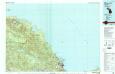
Marquette
1 : 100000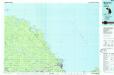
Marquette
1 : 100000
Upper Peninsula, scale six miles to an inch (Marquette County)
1 : 380160 Walling, H. F.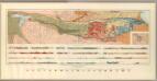
General Geological Map of the Marquette District.
1 : 63360 Van Hise, C.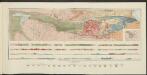
Atlas to accompany monograph XXVIII on the Marquette iron-bearing district of Michigan
1 : 630000 Sheet 4 Van Hise, Charles Richard United States Geological Survey
Atlas to accompany monograph XXVIII on the Marquette iron-bearing district of Michigan
1 : 630000 Sheet 19 Van Hise, Charles Richard United States Geological Survey
Atlas to accompany monograph XXVIII on the Marquette iron-bearing district of Michigan
1 : 630000 Sheet 16 Van Hise, Charles Richard United States Geological Survey
Atlas to accompany monograph XXVIII on the Marquette iron-bearing district of Michigan
1 : 630000 Sheet 13 Van Hise, Charles Richard United States Geological Survey
Atlas to accompany monograph XXVIII on the Marquette iron-bearing district of Michigan
1 : 630000 Sheet 8 Van Hise, Charles Richard United States Geological Survey
Detailed Geology Sheet VIII.
1 : 13200 Van Hise, C.
Atlas to accompany monograph XXVIII on the Marquette iron-bearing district of Michigan
1 : 630000 Sheet 22 Van Hise, Charles Richard United States Geological Survey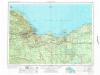
Marquette
1 : 250000
Marquette
1 : 250000
Marquette
1 : 250000

