Maps of Gooding County

Pasadena Valley
1 : 62500
Indian Butte
1 : 24000
Twentymile Butte
1 : 24000
Indian Butte
1 : 24000
Indian Butte
1 : 24000
Indian Butte
1 : 24000
Twentymile Butte
1 : 24000
Ticeska
1 : 24000
Pasadena Valley
1 : 24000
Ticeska
1 : 24000
Ticeska
1 : 24000
Pasadena Valley
1 : 24000
Ticeska
1 : 24000
Ticeska
1 : 24000
Pasadena Valley
1 : 24000
Pasadena Valley
1 : 24000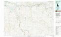
Glenns Ferry
1 : 100000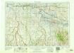
Twin Falls
1 : 250000
Twin Falls
1 : 250000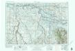
Twin Falls
1 : 250000
Twin Falls
1 : 250000
Twin Falls
1 : 250000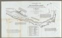
Map Of The Road From Missouri To Oregon ... Section VI.
1 : 633600 Preuss, Charles
Idaho.
1 : 1700000 Rand McNally and Company
Idaho.
1 : 2400000 Mitchell, Samuel Augustus
Territory Of Idaho.
1 : 1013760 U.S. General Land Office
Idaho.
1 : 1950000 Rand McNally and Company
Idaho.
1 : 1330560 Cram Atlas Company
Idaho.
Rand McNally and Company

