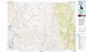
Maps of Gem County

Maps of Gem County

$title$

Weiser

1 : 100000
$title$

Weiser

1 : 125000
$title$

Weiser

1 : 125000
$title$

Weiser

1 : 125000
$title$

Weiser

1 : 125000
$title$

Weiser

1 : 125000
$title$

Squaw Creek

1 : 125000
$title$

Squaw Creek

1 : 125000
$title$

Squaw Creek

1 : 125000
$title$

Squaw Creek

1 : 125000
$title$

Squaw Creek

1 : 125000
$title$

Banks

1 : 62500
$title$

Banks

1 : 62500
$title$

Banks

1 : 62500
$title$

Crane Creek Reservoir

1 : 62500
$title$

Crane Creek Reservoir

1 : 62500
$title$

Mann Creek

1 : 62500
$title$

Mann Creek

1 : 62500
$title$

Smiths Ferry

1 : 62500
$title$

Smiths Ferry

1 : 62500
$title$

Smiths Ferry

1 : 62500
$title$

Birding Island

1 : 24000
$title$

Dry Buck Valley

1 : 24000
$title$

Banks

1 : 24000
$title$

Payette

1 : 24000
$title$

Sheep Ridge

1 : 24000
$title$

Hog Cove Butte

1 : 24000
$title$

Squaw Butte

1 : 24000
$title$

Webb Creek

1 : 24000
$title$

Birding Island

1 : 24000
$title$

Birding Island

1 : 24000
$title$

Birding Island

1 : 24000
$title$

Payette

1 : 24000
$title$

Payette

1 : 24000
$title$

Payette

1 : 24000
© MapTiler © OpenStreetMap contributors
How does it work?
These instructions will show you how to find historical maps online.
Getting started
Type the place name in the search box to find the exact location. You can further adjust the search by zooming in and out.
Zoom
Zoom in and out with the buttons or use your mouse or touchpad natively.
Exact Area tool
Click here and draw a rectangle over the map to precisely define the search area.
Set filters
Narrow your search with advanced settings, such as Years (from/to), Fulltext, Publisher, etc.
Results
See the results of your search on the right side. You can scroll down to find more maps of this location.
?

Download OldMapsOnline Mobile