Maps of Adams County
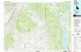
McCall
1 : 100000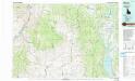
McCall
1 : 100000
Meadows
1 : 125000
Meadows
1 : 125000
Cambridge
1 : 62500
Cambridge
1 : 62500
Sturgill Peak
1 : 62500
Sturgill Peak
1 : 62500
Council
1 : 62500
Council
1 : 62500
Cascade
1 : 62500
Cascade
1 : 62500
Hornet
1 : 62500
Hornet
1 : 62500
Hornet
1 : 62500
New Meadows
1 : 62500
New Meadows
1 : 62500
Hopper Creek
1 : 24000
King Hill Creek
1 : 24000
Cold Spring Ridge
1 : 24000
Sturgill Peak
1 : 24000
Hopper Creek
1 : 24000
Cambridge
1 : 24000
Indian Valley
1 : 24000
East of Cambridge
1 : 24000
King Hill Creek
1 : 24000
Cold Spring Ridge
1 : 24000
Cascade
1 : 24000
Advent Gulch
1 : 24000
Rush Peak
1 : 24000
Goodrich
1 : 24000
Council
1 : 24000
Council Mountain
1 : 24000
Lone Tree
1 : 24000
Advent Gulch
1 : 24000
Neil Gulch
1 : 24000
Rush Peak
1 : 24000
Council
1 : 24000
Council Mountain
1 : 24000
Lone Tree
1 : 24000

