Maps of Westfield

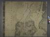
Roselle
1 : 24000
Roselle
1 : 24000
Roselle
1 : 24000
Roselle
1 : 24000
Roselle
1 : 24000
Plainfield
1 : 62500
Plainfield
1 : 62500
Plainfield
1 : 62500
Plainfield
1 : 62500
Plainfield
1 : 62500
Plainfield
1 : 62500
Plainfield
1 : 62500
Plainfield
1 : 62500
Plainfield
1 : 62500
Plainfield
1 : 62500
Plainfield
1 : 62500
Hudson, Union, Essex Cos., N.J.
1 : 126720 Beers, F. W. (Frederick W.)
6 Central red sandstone.
1 : 63360 Vermeule, C. C. (Cornelius Clarkson), 1858-1950
Passaic
1 : 125000
Passaic
1 : 125000
Passaic
1 : 125000
Passaic
1 : 125000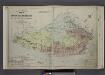
Outline & Index Map of The Borough of Richmond City of New York Published By E. Robinson 1907; Explanation; Note.
from Atlas of the borough of Richmond, city of New York.
Map of Staten Island , Richmond County, Staten Island,New York.
from Atlas of Staten Island, Richmond County, New York, from official records and surveys; compiled and drawn by F. W. Beers.
New York, Brooklyn.
1 : 42500 Beers, F. W. (Frederick W.)
The harbour of New York, Entrance to Chesapeake Bay, coastal views.
1 : 900000 Blunt, Edmund M. (Edmund March), 1770-1862
Staten Island (cont.)
From The Borough
Map of New-York Bay and Harbor and the environs / founded upon a trigonometrical survey under the direction of F. R. Hassler, superintendent of the Survey of the Coast of the United States ; triangulation by James Ferguson and Edmund Blunt, assistants ;
from New York harbor
Index Map / surveyed and published by Chas. B. Brush. Vol. 8.
From Insurance maps of Hudson County, New Jersey