Maps of Lathrop Township

Hop Bottom
1 : 24000
Hopbottom
1 : 24000
Hop Bottom
1 : 24000
Tunkhannock
1 : 62500
Tunkhannock
1 : 62500
Tunkhannock
1 : 62500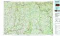
Honesdale
1 : 100000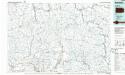
Honesdale
1 : 100000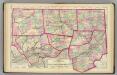
Tioga, Luzerne, Bradford, Sullivan, Wyoming, Susquehanna, Lycoming counties.
1 : 300000 Gray, Ormando Willis; Walling, H. F.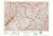
Scranton
1 : 250000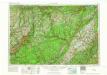
Scranton
1 : 250000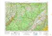
Scranton
1 : 250000
Scranton
1 : 250000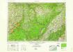
Scranton
1 : 250000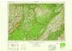
Scranton
1 : 250000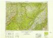
Scranton
1 : 250000
Scranton
1 : 250000
Map of the city and county of New York.
From Manhattan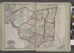
"Delaware, Sullivan, Greene, Ulster, Orange, Columbia, Dutchess, and Putman Counties"
from New topographical atlas and gazetteer of New York, comprising a topographical view of the several counties of the state, ... including ... map of the United States and territories ... Compiled from the latest astronomical observations, official surveys and records of the United States and territories ...
New Jersey.
1 : 680000 Rand McNally and Company
Pennsylvania.
1 : 539000 Rand McNally and Company
Pennsylvania (Eastern Part).
1 : 585000 Hammond, C.S.
A Map Of The State Of Pennsylvania.
1 : 310000 Howell, Reading
A map of the roads leading to the town of Britania in the British settlement, Susquehanna County, Penna. / drawn by H.S. Tanner; T.V.K. & Co. sc.
from Cities and towns, A - Z Henry S. Tanner,
Map of the State of New Jersey
from Atlas of Hunterdon County, New Jersey : from recent and actual surveys and records / under the superintendence of F.W. Beers.
New Jersey / engraved by J.H. Young.
from Whole
The State of New Jersey / compiled from the most accurate surveys / Martin sculpt.
from Whole
Map of the canals and rail roads for transporting anthracite coal from the several coal fields to the city of New York
1 : 322000 Lorenz, William Hunckel & Son
The Province of New Jersey, divided into East and West, commonly called the Jerseys / engraved & published by Wm. Faden, Charing Cross, December 1st, 1777 ; Croisey, sculpt.
from Whole

