Maps of Adams County
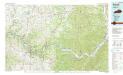
Maysville
1 : 100000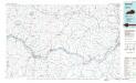
Maysville
1 : 100000
Vanceburg
1 : 62500
Springdale
1 : 62500
Springdale
1 : 48000
Springdale
1 : 62500
Higginsport
1 : 62500
Seaman
1 : 62500
Peebles
1 : 62500
Peebles
1 : 62500
Otway
1 : 62500
Peebles
1 : 62500
Otway
1 : 62500
Otway
1 : 62500
Upper Ohio River and Valley part XXIII, 401 to 418 miles below Pittsburgh ... (with) Aberdeen, Levanna, Brown Co., O.
1 : 31680 Hayes, Eli L.
Upper Ohio River and Valley part XXI, 362 to 381 miles below Pittsburgh ... (with) Buena Vista, Rockville & Commercialtown, Rome, Ohio; Quincy, Ky.
1 : 31680 Hayes, Eli L.
Upper Ohio River and Valley part XXII, 382 to 400 miles below Pittsburgh ... (with) Manchester, Wrightsville, O.
1 : 31680 Hayes, Eli L.
Tollesboro
1 : 24000
Tollesboro
1 : 24000
Mays Lick
1 : 24000
Sardis
1 : 24000
Mays Lick
1 : 24000
Mays Lick
1 : 24000
Sardis
1 : 24000
Orangeburg
1 : 24000
Orangeburg
1 : 24000
Orangeburg
1 : 24000
Vanceburg
1 : 24000
Garrison
1 : 24000
Charters
1 : 24000
Brushart
1 : 24000
Charters
1 : 24000
Charters
1 : 24000
Charters
1 : 24000
Vanceburg
1 : 24000
Vanceburg
1 : 24000
Vanceburg
1 : 24000
Vanceburg
1 : 24000
Garrison
1 : 24000
Garrison
1 : 24000
Garrison
1 : 24000
Brushart
1 : 24000
Garrison
1 : 24000
Garrison
1 : 24000

