Maps of Princeton

Princeton
1 : 62500
Princeton
1 : 62500
Princeton
1 : 62500
Princeton
1 : 62500
Princeton
1 : 62500
Princeton
1 : 62500
Princeton
1 : 62500
Princeton
1 : 62500
Princeton
1 : 62500
Owensville
1 : 24000
Owensville
1 : 24000
Owensville
1 : 24000
Princeton
1 : 24000
Princeton
1 : 24000
Princeton
1 : 24000
Princeton
1 : 24000
East Mount Carmel
1 : 24000
East Mount Carmel
1 : 24000
East Mount Carmel
1 : 24000
Patoka
1 : 24000
Patoka
1 : 24000
Patoka
1 : 24000
Patoka
1 : 24000
Map of Gibson County.
1 : 145000 Baskin, Forster and Company
Patoka
1 : 125000
Patoka
1 : 125000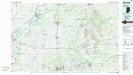
Princeton
1 : 100000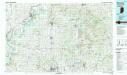
Princeton
1 : 100000
Map of Edwards & Wabash counties and Albion.
1 : 126720 Warner & Beers

