Maps of Wayne County
Leon
1 : 100000
Map of Wayne County, State of Iowa.
1 : 115000 Andreas, A. T. (Alfred Theodore), 1839-1900
Map of Decatur County, State of Iowa.
1 : 126720 Andreas, A. T. (Alfred Theodore), 1839-1900
Lamoni
1 : 62500
Lamoni
1 : 62500
Lamoni
1 : 62500
Seymour
1 : 62500
Seymour
1 : 62500
Seymour
1 : 62500
Russell
1 : 62500
Russell
1 : 62500
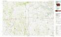
Corydon
1 : 62500
Corydon
1 : 62500
Russell
1 : 62500
Russell
1 : 62500
Humeston
1 : 48000
Corydon
1 : 62500
Corydon
1 : 62500
Lamoni South
1 : 24000
Lamoni South
1 : 24000
Akron
1 : 24000
Lake Thunderhead
1 : 24000
Powersville
1 : 24000
Cleopatra
1 : 24000
Lamoni North
1 : 24000
Davis City
1 : 24000
Seymour West
1 : 24000
Seymour East
1 : 24000
Leon
1 : 24000
Woodland
1 : 24000
Allerton
1 : 24000

