Maps of Mitchell County
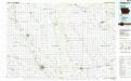
Charles City
1 : 100000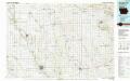
Charles City
1 : 100000
Map of Howard County, State of Iowa.
1 : 154800 Andreas, A. T. (Alfred Theodore), 1839-1900
Map of Mitchell County, State of Iowa.
1 : 154800 Andreas, A. T. (Alfred Theodore), 1839-1900
Map of Chickasaw County, State of Iowa.
1 : 154800 Andreas, A. T. (Alfred Theodore), 1839-1900
Map of Floyd County, State of Iowa.
1 : 120000 Andreas, A. T. (Alfred Theodore), 1839-1900
Lawler
1 : 24000
Waucoma
1 : 24000
Ionia
1 : 24000
New Hampton
1 : 24000
Rockford
1 : 24000
Roseville
1 : 24000
Charles City
1 : 24000
Bassett
1 : 24000
Saude
1 : 24000
Protivin
1 : 24000
Elma
1 : 24000
Jerico
1 : 24000
Rudd
1 : 24000
Orchard
1 : 24000
Floyd
1 : 24000
Colwell
1 : 24000
Saratoga
1 : 24000
Lourdes
1 : 24000
Cresco SW
1 : 24000
Cresco SE
1 : 24000
Osage SW
1 : 24000
Osage
1 : 24000
Riceville
1 : 24000

