Maps of Davis County
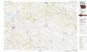
Centerville
1 : 100000
Map of Davis County, State of Iowa.
1 : 154800 Andreas, A. T. (Alfred Theodore), 1839-1900
Map of Appanoose County, State of Iowa.
1 : 126720 Andreas, A. T. (Alfred Theodore), 1839-1900
Centerville
1 : 62500
Centerville
1 : 62500
Ottumwa South
1 : 62500
Ottumwa South
1 : 62500
Mystic
1 : 62500
Mystic
1 : 62500
Omaha
1 : 24000
Bunker Hill
1 : 24000
Kilwinning
1 : 24000
Mendota
1 : 24000
Coatsville
1 : 24000
Lancaster
1 : 24000
Brock
1 : 24000
Azen
1 : 24000
Centerville West
1 : 24000
Centerville East
1 : 24000
Moulton
1 : 24000
West Grove
1 : 24000
Bloomfield South
1 : 24000
Bloomfield South
1 : 24000
Milton
1 : 24000
Cantril
1 : 24000
Bloomfield North
1 : 24000
Bloomfield North
1 : 24000
Floris
1 : 24000
Floris
1 : 24000
Paris
1 : 24000
Unionville
1 : 24000
Mystic
1 : 24000
Hiattsville
1 : 24000
Selma
1 : 24000

