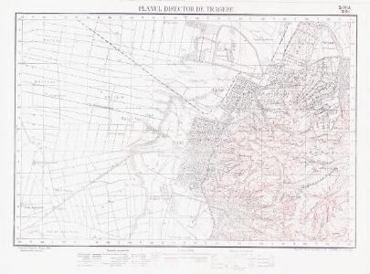
Maps of Arad
Lambert-Cholesky sheet 1964 (Şiria)
1 : 20000 Romanian military topographic map sheet under Lambert-Cholensky projection Institutul Geografic Militar geo-spatial.org Institutul Geografic Militar
Apatelek und Simano.
from Spezialkarte der osterreichisch-ungarischen Monarchie.
Apatelek
1 : 75000 Arad (Judeţ)
Arader Comitat
1 : 290000
Arader Comitat
1 : 288000 Arad (Rumunsko)
C. Aradiensis
Rumänien Komitat Arad (Rumänien)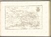

Generalkarte von Zentraleuropa

A szerbek aránya és száma a Dél-Alföldön 1880-ban
Großes Ungarisches Tiefland (Süd) Serben, Siedlung Bottlik, Zsolt
Serben in der Südlichen Tiefebene 1880
Großes Ungarisches Tiefland (Süd) Serben, Siedlung Bottlik, Zsolt
A szerbek aránya és száma a Dél-Alföldön 1941-ben
Großes Ungarisches Tiefland (Süd) Serben, Siedlung Bottlik, Zsolt
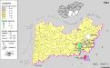
A szerbek aránya és száma a Dél-Alföldön 1980-ban
Großes Ungarisches Tiefland (Süd) Serben, Siedlung Bottlik, Zsolt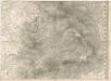
Das Oesterreichische-Kaiserthum

Plan von Bergwerg Laposneck
Mollova mapová sbírka Geyer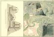
Plan des Bergwergs zu Lupkovo
Mollova mapová sbírka Geyer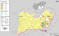
Siedlungsgebiet der Slowaken nach dem Nachbarschaftsindex für die Südliche Tiefebene 1880
Ungarn (Süd) Slowaken, Siedlung Bottlik, Zsolt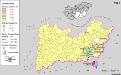
Siedlungsgebiet der Slowaken nach dem Nachbarschaftsindex für die Südliche Tiefebene 1941
Ungarn (Süd) Slowaken, Siedlung Bottlik, Zsolt
A szlovákok településterülete a szomszédsági mutató alapján Dél-Alföldön 1880-ban
Ungarn (Süd) Slowaken, Siedlung Bottlik, Zsolt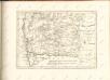

Szeged és Debrecen
1 : 750000 Debrecín (Maďarsko : oblast) M. Kir. Állami Térképészet
Siedlungsgebiet der Slowaken nach dem Nachbarschaftsindex für die Südliche Tiefebene 1980
Ungarn (Süd) Slowaken, Siedlung Bottlik, Zsolt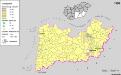
A szlovákok településterülete a szomszédsági mutató alapján Dél-Alföldön 1980-ban
Ungarn (Süd) Slowaken, Siedlung Bottlik, Zsolt
A Tisavölgy vizszabályozasi átnézeti térképe
A szlovákok településterülete a szomszédsági mutató alapján Dél-Alföldön 1941-ban
Ungarn (Süd) Slowaken, Siedlung Bottlik, Zsolt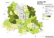
Vojvodina 1900. Deutsche
Wojwodina ethnische Gruppe, Deutsche Hofinger, Veronika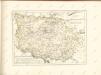

Die Donau, der Fürst aller Europaeischen Flüsse :
Mollova mapová sbírka Hoffmann, Johannes Hoffmann, Johann
Rumänen in Ost-Ungarn 1941
Ungarn (Ost) Rumänen, Siedlung Bottlik, Zsolt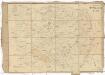
Carte von Temescher Banat
1 : 220000 Banát Péchy von Péchyujfalu