Maps of Arad
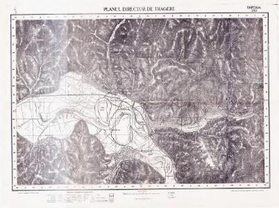
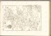
Lambert-Cholesky sheet 2162 (Bârzava)
1 : 20000 Romanian military topographic map sheet under Lambert-Cholensky projection Serviciul Geografic al Armatei geo-spatial.org Serviciul Geografic al Armatei
Nádas
1 : 75000 Bezirk Timiş
Nada und Soborsin.
from Spezialkarte der osterreichisch-ungarischen Monarchie.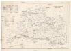
Arader Comitat
1 : 290000
Arader Comitat
1 : 288000 Arad (Rumunsko)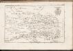
C. Aradiensis
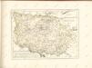
Rumänien Komitat Arad (Rumänien)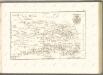

C. Temesiensis
Rumänien Komitat Temesvár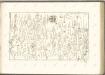

Süd-Ost-Ungarn
1 : 600000 Österreich-Ungarn (Südost), Banat
C. Krassó
Rumänien Komitat Caraşova
Generalkarte von Zentraleuropa
Das Oesterreichische-Kaiserthum

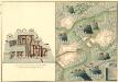
Plan von Bergwerg Laposneck
Mollova mapová sbírka Geyer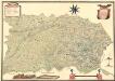
Mappa Der Grenz Scheidung Des Banat Temeswar Von Anno 1749 Mit Den Türken Geschlosen Von Herren General Feldmarschaů Lieutinont Freiheren Frantz Von Engelshofen A. 1749
Mollova mapová sbírka Geyer
Théatre de la Guerre dans le Bannat de Temeswar
1 : 510000 Mollova mapová sbírka Briffaut, Etienne Briffaut, Etienne
Das Temeschwarer Bannat
1 : 389000 Banát Güssefeld, Franz L. Liesganig, Joseph von den Homann. Erben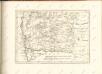

A Tisavölgy vizszabályozasi átnézeti térképe

Die Donau, der Fürst aller Europaeischen Flüsse :
Mollova mapová sbírka Hoffmann, Johannes Hoffmann, Johann
Tabula Bannatus Temesiensis a Geometris S.S.M.M.I.I. et R.A. confecta; quam in minorem formam reduxit, gradusque longitudinis, et latitudinis adjecit Franciscus Griselini. Augustinus Cipps sculpsit
1 : 480000 Temescher Banat Griselini, Francesco, http://d-nb.info/gnd/129735183; Cipps, Augustin, http://d-nb.info/gnd/130565644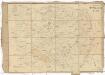
Carte von Temescher Banat
1 : 220000 Banát Péchy von Péchyujfalu
Ober Ungern
Rumunsko Kipferling, Karl Joseph im Verlage des Kunst und Industrie Comptoir's
Ober Ungern
Rumunsko Kipferling, Karl Joseph im Verlage des Kunst und Industrie Comptoir's
Rumänen in Ost-Ungarn 1980
Ungarn (Ost) Rumänen, Siedlung Bottlik, Zsolt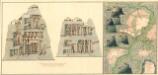
Plan dern Bergwerg bei Carlburg und Vardia
Mollova mapová sbírka Geyer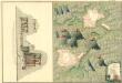
Plan von Bergwerg Pestian und Ivota
Mollova mapová sbírka Geyer