Maps of Bihor
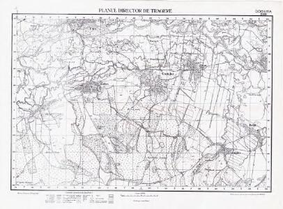
Lambert-Cholesky sheet 2169 (Cociuba)
1 : 20000 Romanian military topographic map sheet under Lambert-Cholensky projection Serviciul Geografic al Armatei geo-spatial.org Serviciul Geografic al Armatei
Okros.
from Spezialkarte der osterreichisch-ungarischen Monarchie.
Tenke und Kardo.
from Spezialkarte der osterreichisch-ungarischen Monarchie.
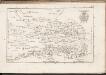
Ökrös
1 : 75000 Judeţ Bihor
Zone 19, Kol. XXVI, Ökrös, uit: [Geologische Specialkarte der im Reichsrathe vertretenen Königreiche und Länder der österreichisch-ungarischen Monarchie] / geologische Aufnahmen der königl. ung. Geologischen Anstalt
1 : 75000 Annotatie: Verantwoordelijkheidsvermelding in 1909 veranderd in: Königliche Ungarische Geologische Reichsanstalt; Sommige bladen in het Frans; Annotatie geografische gegevens: Coördinaten gebaseerd op nulmeridiaan van Ferro (Hierro) Königliche Ungarische Geologische Reichsanstalt; Königliche Ungarische Geologische Anstalt Budapest : [Königliche Ungarische Geologische Anstalt]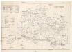
Arader Comitat
1 : 290000
Arader Comitat
1 : 288000 Arad (Rumunsko)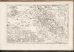
C. Bihariensis. Tab. II
Ungarn Rumänien Komitat Bihar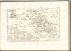
C. Aradiensis
Rumänien Komitat Arad (Rumänien)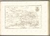

Süd-Biharer Comitat
1 : 290000 Bihor (Rumunsko)
Süd-Biharer Comitat
1 : 288000 Bihor (Rumunsko : judet)
Süd-Biharer Comitat
1 : 288000 Bihor (Rumunsko)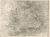
Das Oesterreichische-Kaiserthum

Partis Hungariae Inter Tibiscum et Nigrum Chrysum Nova et Accurata Descriptio
1 : 530000 Mollova mapová sbírka Valk, Gerhard Schenk, Peter I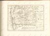

Szeged és Debrecen
1 : 750000 Debrecín (Maďarsko : oblast) M. Kir. Állami Térképészet
A Tisavölgy vizszabályozasi átnézeti térképe

Die Donau, der Fürst aller Europaeischen Flüsse :
Mollova mapová sbírka Hoffmann, Johannes Hoffmann, Johann
Rumänen in Ost-Ungarn 1941
Ungarn (Ost) Rumänen, Siedlung Bottlik, Zsolt
Rumänen in Ost-Ungarn 1880
Ungarn (Ost) Rumänen, Siedlung Bottlik, Zsolt
Rumänen in Ost-Ungarn 1980
Ungarn (Ost) Rumänen, Siedlung Bottlik, Zsolt
Sheet IX: Karte Des Oesterreichischen Kaiserstaates.
1 : 576000 Scheda, Josef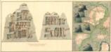
Plan dern Bergwerg bei Carlburg und Vardia
Mollova mapová sbírka Geyer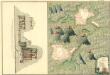
Plan von Bergwerg Pestian und Ivota
Mollova mapová sbírka Geyer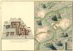
Plan der Bergwerg, Flod, Gilamare und Giogy
Mollova mapová sbírka Geyer
A rományok aránya és száma Kelet-Magyarországon 1941-ben
Ungarn (Ost) Rumänen, Siedlung Bottlik, Zsolt
A rományok aránya és száma Kelet-Magyarországon 1980-ban
Ungarn (Ost) Rumänen, Siedlung Bottlik, Zsolt