Maps of Reni

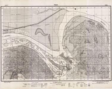
Lambert-Cholesky sheet 5355 (Pisica)
1 : 20000 Romanian military topographic map sheet under Lambert-Cholensky projection Direcția Topografică Militară geo-spatial.org Direcția Topografică Militară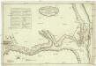
Plan preslědovanija za neprijatelem korpusom gospodina generala kvartermistra Bauera, do rěki Dunaja 21. julja v četvertago času po poludni iz zanjatago lagerja po pobědě nad neprijatelem pri rječki Kagulě, na kotorom naznačen i prežnej retrašament neprijatelskoj 1770 godu julja 23. dnja
1 : 7500 Besarábie (Moldavsko a Ukrajina)
Lambert-Cholesky sheet 5356 (Câsliţa)
1 : 20000 Romanian military topographic map sheet under Lambert-Cholensky projection Serviciul Geografic al Armatei geo-spatial.org Serviciul Geografic al Armatei
Lambert-Cholesky sheet 5354 (Văcăreni)
1 : 20000 Romanian military topographic map sheet under Lambert-Cholensky projection Direcția Topografică Militară geo-spatial.org Direcția Topografică Militară
Mačinski budžak
1 : 300000 Rumänien Dobrudscha
Ostia Danubij
Mollova mapová sbírka Hoffmann, Johannes Hoffmann, Johann
Harta Cailor de Comunicatie din Jud. Covurluiu
Rumänien Judeţul Covurlui Verkehrsweg
Harta Cailor de Comunicatie din Judetul Tulcea
Rumänien Judet Tulcea Verkehrsweg
Carte dessigneé du delta du Danube
1 : 280000 Dunaj-delta (Rumunsko a Ukrajina)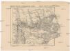
Russisch türkischer Kriegsschauplatz in Europa
1 : 584000 Dunaj-delta (Rumunsko a Ukrajina) Alois Hynek
Donaudelta
1 : 5000000 Donaudelta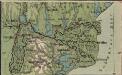
Italien und Balkanhalbinsel. Nebenkarten II. 4. Donaudelta
Donaudelta
Gouv. 25. Kiew, 27. Pultawa
1 : 2200000 1 Karte : Lithographie ; 19 x 27 cm Schlieben, W.E.A. von [Georg Joachim Göschen]
Donau-Delta
1 : 2000000 Donaudelta
Plan des tapfern Angriffs und vollkommenen Sieges der russisch-kayserlichen Waffen über die Turkische und Tatarische Arméé an der Large in der Moldau den 7. Iuly 1770
1 : 40000 Moldavsko
Trigonometrisk grunnlag, vedlegg 65, 2-5: Grunnlagspunkter for Struves meridianbue fra Bessarabia og Volhynia
1 : 200000 de Tenner
Karta na Dobrudža
1 : 750000 Rumänien Dobrudscha
Carte de la Roumanie et pays limitrophes. Galatz
1 : 500000 France. Service géographique de l'armée [Paris] : Service géographique de l'armée
Carte de la Roumanie et pays limitrophes. Odessa
1 : 500000 France. Service géographique de l'armée [Paris] : Service géographique de l'armée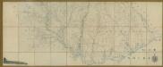
Carte de la Moldavie
1 : 330000 Moldawien, Bessarabien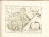

Bez titulu: Šest listů speciálních map Ukrajiny

Galati. Medgidia. Ismail. Silistra. Balcic

Galaz, Medžidie, Ismail, Silistria, Balčik
1 : 750000 Balčik (Bulharsko) Budik, Ad. K. u. k. Militärgeographisches Institut
Galaz, Medžidie, Ismail, Silistria, Balčik
1 : 750000 Balčik (Bulharsko) K. k. militär-geographisches Institut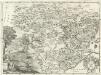
Moldavia.
1 : 1800000 Mollova mapová sbírka Bruggen, Johann van der Brugge, Johannes van der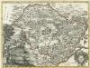
Moldavia
1 : 1800000 Mollova mapová sbírka Pfeffel, Johann Andreas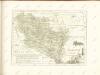

Kʺ pochodu 1711 goda.
Moldawien Nordischer Krieg <1700-1721>