Maps of Maramures
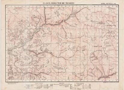
Lambert-Cholesky sheet 3481 (Vârful Pietrosul)
1 : 20000 Romanian military topographic map sheet under Lambert-Cholensky projection Institutul Geografic Militar geo-spatial.org Institutul Geografic Militar
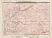
Ruszpolyana.; Spezialkarte der osterreichisch-ungarischen Monarchie.
from Spezialkarte der osterreichisch-ungarischen Monarchie. Austro-Hungarian Monarchy. Militärgeographisches Institut.,
Ruszpolyána
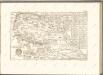
1 : 75000 Maramureş (Judeţ) Geripp: Assistent Pflügl. Terrain: Oberlt. Blaschke
III. vojenské mapování 4873
1 : 75000

Generalkarte von Zentraleuropa

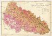
Máramaros vármegye térképe
1 : 500000 Maramureş (Rumunsko) Kogutowicz, Manó Magyar Földrajzi Intézet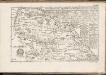
C. Marmarus
Rumänien Komitat Marmarosch
Comitat Marmaros
1 : 288000 Maramureş (Rumunsko)
Comitat Marmaros
1 : 280000 Marmarošská Sihoť (Rumunsko : oblast)
Generalkarte von Zentraleuropa
Podkarpatská Rus
1 : 225000 Podkarpatská Rus (Ukrajina) Gregor, František Novotný a Bartošek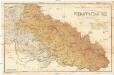
Podkarpatská Rus
1 : 225000 Podkarpatská Rus (Ukrajina) Gregor, František Novotný a Bartošek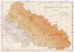
Podkarpatská Rus
1 : 225000 Podkarpatská Rus (Ukrajina) Gregor, František Novotný a Bartošek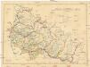
Podkarpatská Rus
1 : 300000 Podkarpatská Rus (Ukrajina) Referát min. veř. prací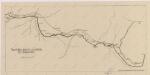
Sbírka map a diagramů použitých na mírových konferencích v Paříži v letech 1919 - 1920

[Bukowina, Galizien]
1 Karte : Kupferdruck ; 18 x 13 cm [Trattner]
Wurzland
Mollova mapová sbírka Hoffmann, Johannes Hoffmann, Johann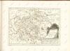

Russia
Mollova mapová sbírka Hoffmann, Johannes Hoffmann, Johann
Siebenbürgen
Sedmihradsko (Rumunsko) Kipferling, Karl Joseph im Verlage des Kunst und Industrie Comptoir's
Kolozsvár (Klausenburg), Máramaros-Sziget, Tölgyes
1 : 750000 Cluj-Napoca (Rumunsko) Erben, F. K. u. k. Militärgeographisches Institut
Kolozsvár (Klausenburg), Máramaros-Sziget, Tölgyes
1 : 750000 Cluj-Napoca (Rumunsko) Erben, F. K. u. k. Militärgeographisches Institut
Klausenburg, Máramaros-Sziget, Tölgyes
1 : 750000 K. u. k. militär-geographisches Institut
Klausenburg, Máramaros-Sziget, Tölgyes
1 : 750000 Cluj-Napoca (Rumunsko) K. k. militär-geographisches Institut
Ober Ungern
Rumunsko severní im Verlage des Kunst und Industrie Comptoirs
Ober Ungern
Rumunsko severní Ossenbrug, J. von Müller, Franz im Verlage des Kunst und Industrie Comptoirs
Vermehrte und Verbesserte Landkarten des Königreichs Ungarn :
1 : 500000 Mollova mapová sbírka Stier, Martin Böner, Johann-Alexander Endter, Martin