Maps of Europe
Tabvla Rvssiæ / ex autographo, quod delineandum curavit Foedor filius tzaris Boris desumta; et ad f
1 : 9000000 1 Karte : Kupferdruck ; 41 x 53 cm Fëdor excusum apud Guiljelmum Blaeu
Tabula Russiae ex autographo, quod delineandum curavit Foedor filius Tzaris Bori et ad fluvios Dwina
1 : 1100000 1 Karte : Kupferdruck ; 27 x 34 cm [Matthäus Merian d. Ältere]
Carte de la Pologne à son apogee, sous Sigismond-Auguste, en face du Principat de Russie sous le czar Ivan IV, vers l’an 1570 de notre ère
Polen Russland Polen-Litauen Zygmunt August
MOSCOVIAE seu RUSSIAE MAGNAE Generalis Tabula
1 : 10500000 Dánsko Seutter, Matthäus per Matth. Seutter
Mapa slovanského světa

Volkerkarte von Russland.
1 : 13300000 Andree, Richard
Russland
1 : 15000000 Evropa východní Kocen, Blaž Eduard Hölzel
Russia in Europe.
1 : 7450000 Hughes, William
Eastern Europe.
1 : 14495100 Fisher, Richard Swainson
Russia, Sweden, Norway.
1 : 15000000 Mitchell, Samuel Augustus
Russia, Sweden, Norway.
1 : 15000000 Mitchell, Samuel Augustus
Russia, Sweden, Norway.
1 : 15000000 Mitchell, Samuel Augustus Jr.
Russia, Sweden, Norway.
1 : 15000000 Mitchell, Samuel Augustus
Russia, Sweden, Norway.
1 : 15000000 Mitchell, Samuel Augustus
Russia In Europe, Sweden, And Norway.
1 : 15000000 Mitchell, Samuel Augustus
Mapa slovanského světa

Mapa slovanského světa
Tabula Russiae ex mandato Foedor Borissovitsj delineata ... Magno domino, Tzari et magno duci Michäeli Foedrowits omnium Russorum autocratori... dedicata a Nicolao Ioannis Piscatore
1 : 10000000 Annotatie: Met breedte- en lengtegraden; Origineel is Blad 136 in atlas factice; Annotatie geografische gegevens: 2 schaalstokken: Wirst seu milliaria Russica en Milliaria Germanica; Inzet: Celeberrima ingens et imperialis civitas Moscua; Russche Narva sive Ivane-gorod; Archangel sive Archangelscka-goroda; Curia Imperatoris Russi appellata Kremelena-gorod; Hypocausta Russorum; Molendina Russorum Fjodor Borissovitsj Godoenov 17e E.; Claes Jansz. Visscher 1586/1587-1652 [S.l. : C.J. Visscher Excudebat]
Composite: Ost-Europa, Norwegen, Schweden, Russland, Kaukasien, Turkei .
1 : 3700000 Petermann, A.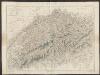
Tabula Russiae ex autographo, quod delineandum curavit Foedor filius Tzaris Boris desumta [...] [Karte], in: Theatrum orbis terrarum, sive, Atlas novus, Bd. 1, S. 67.
1 Karte aus Atlas Blaeu, Joan Blaeu, Willem Janszoon
Novissima Russiae Tabula [Karte], in: Gerardi Mercatoris et I. Hondii Newer Atlas, oder, Grosses Weltbuch, Bd. 1, S. 124.
1 Karte aus Atlas Mercator, Gerhard und Hondius, Jodocus Jansson, Jan

Soubor němých map pro gymnasia a odborné školy

Europäisches Russland
1 : 5000000 Rusko západní Handtke, Friedrich Carl Flemming, Verlag, Buch- und Kunstdruckerei
Ruszland
1 : 12000000 Russland / Europäischer Teil
Russland beim Tode Peters d. Gr. 1725
Russland
Sclagraphia Celticae sivè Evropae Antiqvae Cuius Antiquissimi Incolae Hyperborei, Scythaeeq; dein Celto-Scythae tandem Celtae, postea extra Montes Pereneos in Universum Galli Auctoribus plerumq; nuncupati
1 : 45000000 Mollova mapová sbírka Clüver, Philipp Fuhrmann, Mathias
Novissima Russiae Tabula [Karte], in: Novus atlas absolutissimus, Bd. 1, S. 70.
1 Karte aus Atlas Janssonius Offizin
Europaeisches Russland auch Schweden u. Norwegen dabei Uebersicht des oesterreichischen u. preussischen Staats
1 : 10020000 Norsko Thiel, L. Justus Perthes