Mapa catalogado
Die Grafschaft Oetingen


Título completo:Die Grafschaft Oetingen
Año de ilustración:1789 - 1806
Editorial:F. J. J. von Reilly
Tamaño físico:20 x 30 cm
Die gefürstete Probstey Ellwangen
1806
Reilly
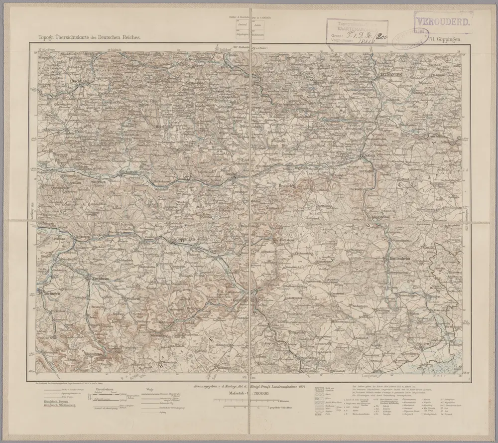
171. Göppingen, uit: Topographische Uebersichtskarte des Deutschen Reiches / herausgegeben v. d. Kartogr. Abt. d. Königl. Preuß. Landesaufnahme
1899
Königlich Preußische Landesaufnahme. Kartographische Abtheilung
1:200k
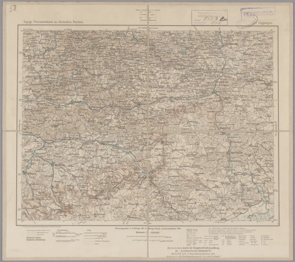
171. Göppingen, uit: Topographische Uebersichtskarte des Deutschen Reiches / herausgegeben v. d. Kartogr. Abt. d. Königl. Preuß. Landesaufnahme
1899
Königlich Preußische Landesaufnahme. Kartographische Abtheilung
1:200k
Novissima et accurata tabula geographica principalis S. R. I. præposituræ Ellevacensis
1742
Seutter; Lotter
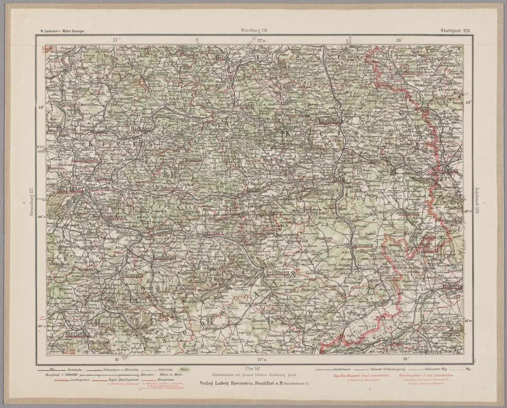
Stuttgart 128, uit: Special-Karte von Mittel-Europa / nach amtlichen Quellen bearbeitet von W. Liebenow
1899
Johannes Wilhelm Liebenow 1822-1897
1:300k
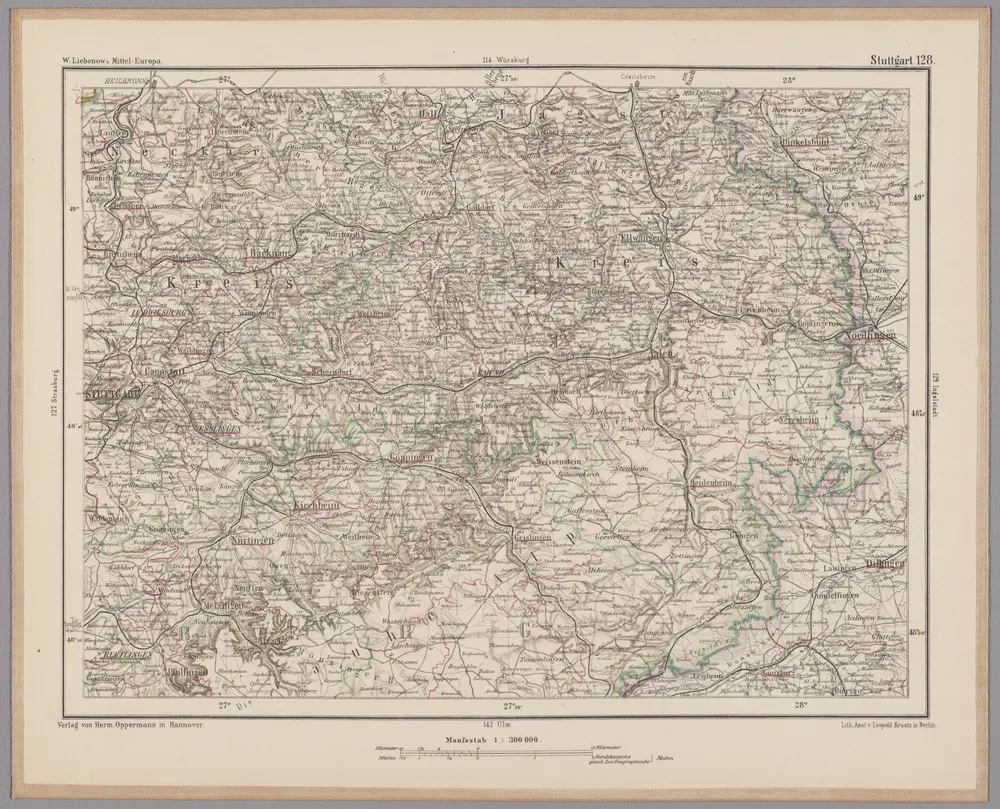
Stuttgart 128, uit: [W. Liebenow's Special-Karte von Mittel-Europa]
1870
Johannes Wilhelm Liebenow 1822-1897
1:300k
Suevia universa IX. tabulis delineata, 2
1740
s.n.
Nova et accurata territorii Vlmensis cum dominio Wainensi descriptio
1715
Lauterbach; Homann
Nova et accurata territorii Vlmensis cum dominio Wainensi descriptio
1715
Lauterbach; Homann
Die Grafschaft Oetingen
1806
Reilly