Maps of Poland

Polonia et Silesia
1 Karte : Kupferdruck ; 33 x 44 cm Mercator; Hondius Henricus Hondius
Polonia et Silesia
1 Karte : Kupferdruck ; 33 x 44 cm Mercator s.n.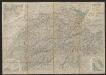
Polonia Et Silesia [Karte], in: Gerardi Mercatoris et I. Hondii Newer Atlas, oder, Grosses Weltbuch, Bd. 1, S. 340.
1 Karte aus Atlas Mercator, Gerhard und Hondius, Jodocus Jansson, Jan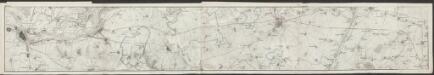
Polonia Et Silesia [Karte], in: Gerardi Mercatoris Atlas, sive, Cosmographicae meditationes de fabrica mundi et fabricati figura, S. 409.
1 Karte aus Atlas Mercator, Gerhard Montanus, Petrus
POLONIA | Regnum, et | SILESIA | Ducatus.
Guiljelmus | Blaeu excudit.


Mapa gęstości zaludnienia Polski
1 : 3000000 Polsko Lencewicz, Stanisław Uniwersytet Warszawski
Lidová republika polská
Polonia Regnum, et Silesia Ducatus. [Karte], in: Theatrum orbis terrarum, sive, Atlas novus, Bd. 1, S. 102.
1 Karte aus Atlas Blaeu, Joan Blaeu, Willem Janszoon
Mapa samochodowa Polski

Polonia regnvm
Polsko Bouttats, Gaspar
Polonia Regnum, et Silesia Ducatus. [Karte], in: Le théâtre du monde, ou, Nouvel atlas contenant les chartes et descriptions de tous les païs de la terre, Bd. 1, S. 94.
1 Karte aus Atlas Blaeu, Willem Janszoon und Blaeu, Joan Blaeu, Willem Janszoon
Partie, l'Allemagne. Europe 14.
1 : 1641836 Vandermaelen, Philippe, 1795-1869
Polonia Regnum, et Silesia Ducatus. [Karte], in: Novus Atlas, das ist, Weltbeschreibung, Bd. 1, S. 73.
1 Karte aus Atlas Blaeu, Joan Blaeu, Willem Janszoon
Polonia Regnum, et Silesia Ducatus
1 : 1600000 Mollova mapová sbírka Blaeu, Willem Janszoon Bleau, Willem Janszon
Herzogthum Warschau
1 : 2310000 Varšava (Polsko : oblast)
Polsko, Prusy, Poznáňsko [sic]
1 : 3890000 Polsko
Novissima Poloniae regni Descriptio
1 : 1600000 Mollova mapová sbírka Janssonius, Johannes Janssonius, Johannes I
Novissima Poloniae Regni Descriptio. [Karte], in: Novus atlas absolutissimus, Bd. 1, S. 90.
1 Karte aus Atlas Janssonius Offizin

Germany. Deutschland II.
1 : 1760000 Society for the Diffusion of Useful Knowledge (Great Britain)
Polonia Propria
1 : 1400000 Mollova mapová sbírka Homann, Johann Baptist Homann, Johann Baptista - dědici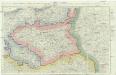
Neue militairische Situations- und Post-Carte von Polen und Preussen
1 : 900650 Polsko Knittel, I. E. Friedrich Campe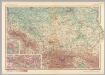
Poland - South. Pergamon World Atlas.
1 : 1250000 Polish Army Topography Service
III. vojenské mapování 3959
1 : 75000
TABULA NOVA POLONIAE et SILESIAE
1 : 1800000 Gdaňsk (Polsko) Goos, Abraham impreßa in aedibus Nicolaij Iohannis Vißcher
Karte vom Herzogthum Warschau, und den angrenzenden Staaten in IV Sectionen
1 : 650000 Polsko Engelhardt, Friedrich Bernhard Mare, Carl Simon Schropp & Comp.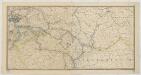
Karte der Eisenbahnen Deutschlands
1 : 700000 Südost-Blatt Stich, Druck u. Verlag des lithographischen Instituts von Aug. Wehrt


