Mappa catalogata
Territorii Novoforensis in svperiore palatinatu accurata descriptio


Titolo completo:Territorii Novoforensis in svperiore palatinatu accurata descriptio
Anno di illustrazione:1683
Editore:Janssonius van Waesbergen - Pitt - Swart
Dimensione fisica:20 x 30 cm
Pars prima continet partem marchion: Onoldin: palat: Sultzbac: Neoburg: episc: Aichstad: Reipubl: Nurimberg: et incertas regiones
1745
Heinrich Ludwig Broenner
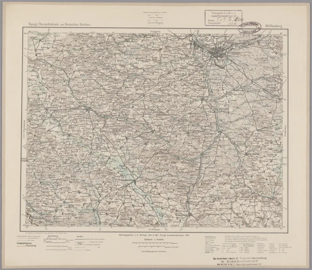
163. Nürnberg, uit: Topographische Uebersichtskarte des Deutschen Reiches / herausgegeben v. d. Kartogr. Abt. d. Königl. Preuß. Landesaufnahme
1899
Königlich Preußische Landesaufnahme. Kartographische Abtheilung
1:200k
Territorii Novoforensis in svperiore palatinatu accurata descriptio
1683
Rittershausen; Pitt; Swart; Janssonius van Waesbergen
Territorii Novoforensis in svperiore palatinatu accurata descriptio
1690
Rittershausen; Schenk; Valck
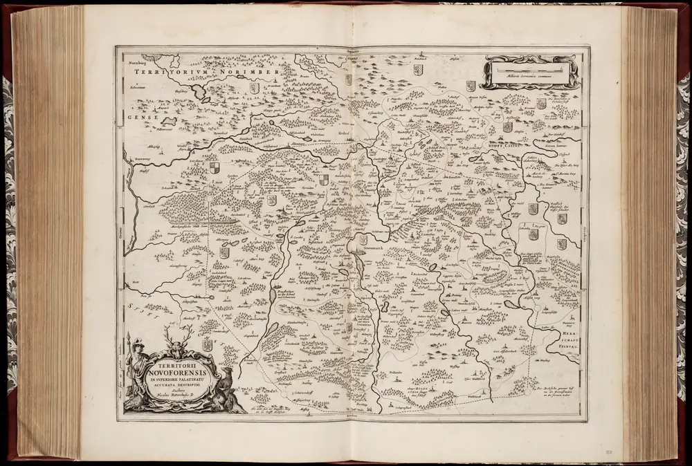
Territorii Novoforensis in svperiore Palatinatu accurata descriptio / auctore Nicolao Rittershusio D
1662
Nicolaus Rittershausen 1597-1670
1:100k
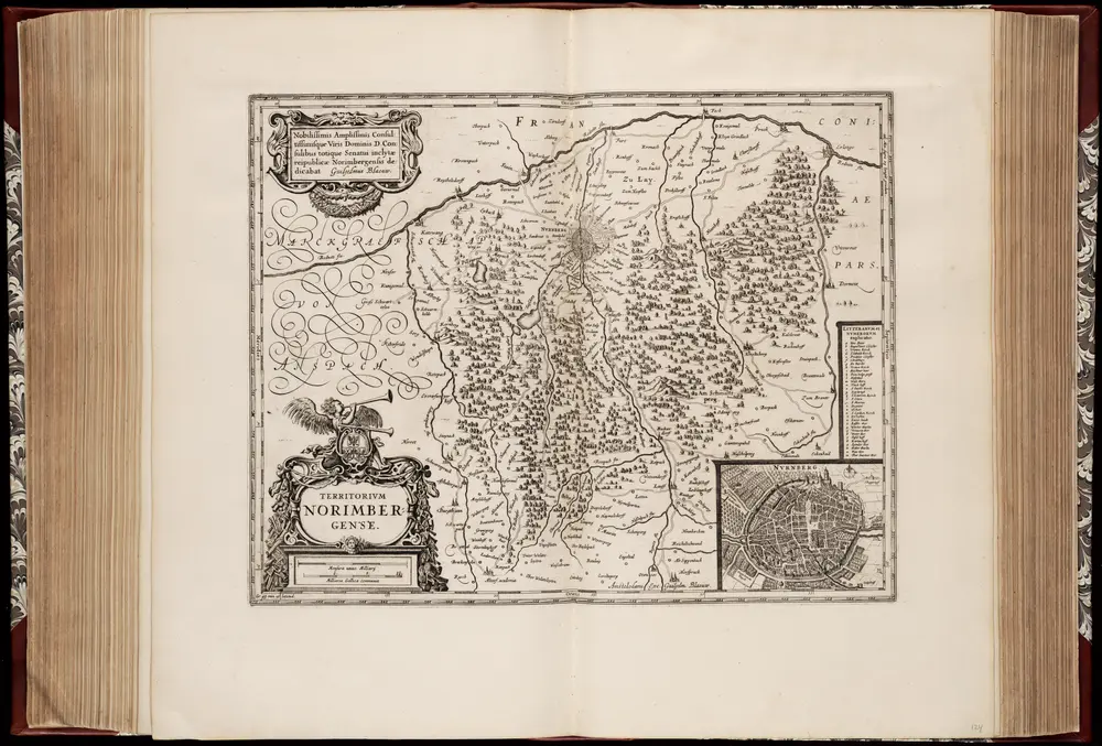
Territorivm Norimbergense
1631
Willem Jansz Blaeu 1571-1638
1:200k

Neuer Atlas Uber die Gantze Welt, mapa ze strany: [241]
1714
Homann Johann Baptist
Sacri Romani imperii circuli et electoratus Bavariae tabula, 3
1684
s.n.
Carte topographique d'Allemagne contenant la Franconie sçavoir une partie des evechés de Wurzbourg de Bamberg
1789
Jaeger; Facius
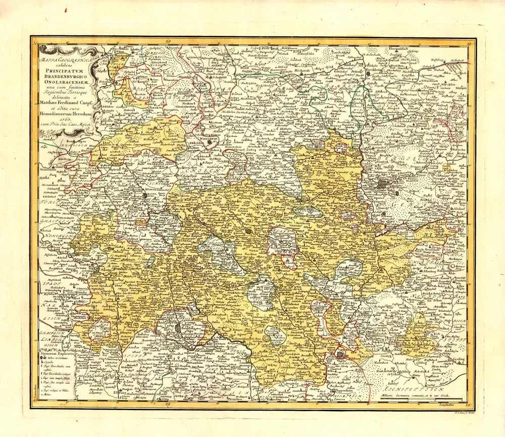
Mappa geographica exhibens principatvm Brandenbvrgico Onolsbacensem
1763
Cnopf, Matthäus Ferdinand