Maps of Germany

General Karte vom Deutschen Reich
1 Karte : Kupferdruck ; 57 x 63 cm Carmine zu finden bei Joseph Carmine
Charte von Deutschland

Germany.
1 : 6000000 Carey, Mathew
Germany.
1 : 6000000 Carey, Mathew
Regni Germaniae delineatio, secundum X. Circulorum divisionem veram suam figuram hodiernos circulorum et regni totius exacte referens
1 : 7900000 Mollova mapová sbírka Franz, Johann Michael Homann, Johann Baptista - dědici
Eisen-Bahn-Atlas von Deutschland, Belgien, Elsass und dem nördlichsten Theile von Italien
Stülpnagel, Friedrich von ; Bär, J.C. Justus Perthes
Karte der fahrbaren oder im Bau begriffenen und der ernstlich projectirten Eisenbahnen in Deutschland, Belgien und Holland, so wie desgleichen einiger in Frankreich, in der Schweiz, in Italien und in Polen
1 : 2470000 Belgie Müller, Emil bey Hoffmann & Campe
Neu-vermehrte Post-Charte durch gantz Teutschland nach Italien, Franckreich, Niederland, Preußen, Polen und Ungarn &c.
1 : 2500000 Mollova mapová sbírka Nell, Johann Peter Homann, Johann Baptista
Empire d'Allemagne, divisé en ses dix cercles, ces cercles en leurs principaux estats
1 : 2810000 Evropa střední Sanson, Nicolas Cordier, Louis Pierre Mariette
Societas Iesu Germana Sive Assistentia Germaniae
1 : 2600000 Mollova mapová sbírka Seutter, Matthäus Seutter, Georg Matthäus Seutter, Matthäus

(Teutschland, Pohlen, Ungarn, Turcken, Russland)
Hubner, Johann, 1688-1731
Charte das Deutsche Reich nach seinen Kreisen und deren Unterabtheilungen vorstellend
1 : 2660000 Francie Güssefeld, Franz L. von den Homännischen Erben
Charte das Deutsche Reich nach seinen Kreisen und deren Unterabtheilungen vorstellend
1 : 2660000 Evropa střední Güssefeld, Franz L. von den Homännischen Erben
Deutschland und anliegende Länder, zur Übersicht der Hauptstrassen und Entfernungen
Hand-Atlas über alle Theile der Erde nach dem neuesten Zustande und über das Weltgebäude Stieler, Adolf bei Justus Perthes
Karte von Teutschland
Německo Ritter, C.
Neueste Charte von Deutschlandt ...

Neu vermehrte Post Charte durch gantz Teutschland nach Italien, Franckreich, Niederland, Preußen, Polen, und Ungarn & c
1 : 2600000 Evropa střední Nell, Johann Peter Homann, Johann Baptist Iohann Baptist Homann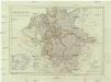
Deutschland nach den letzten Friedenschlüssen
1 : 3600000 Evropa střední Mollo, Tranquillo bey Tranquillo Mollo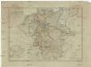
Deutschland nach den letzten Friedenschlüssen
1 : 3600000 Evropa střední Mollo, Tranquillo Tranquillo Mollo
Charte von Teutschland
1 : 2210000 Německo Güssefeld, Franz L. im Verlage des geographischen Instituts
Neue und vollstandige Postkarte durch ganz Deutschland
1 : 1480000 Německo Bors zu Overen, Johann Jakob Breidbach zu Bürresheim, Emmerich Joseph von bey dennen Homaennischen Erben
General-Charte von Teutschland nach den besten Quellen bearbeitet und den neuesten politischen Veraenderungen begrenzt
1 : 2027520
Imperium Romano-Germanicum in suos circulos electorat. et status
1 : 5100000 Evropa střední Seutter, Matthäus Lotter, Tobias Conrad apud Matth. Seutter
[Recto], uit: Post- und Eisenbahn-Karte von Deutschland, den Niederlanden, Belgien und der Schweiz / bearb. nach L. Friedrich's Post-, Eisenbahn- & Reisekarte von Mittel-Europa
1 : 1800000 Annotatie: Ondertitel op omslag: Bis Calais & Paris, Rügen & Königsberg, Krakau & Pesth, Venedig & Grenoble Gotha : Perthes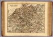
Carte exacte des postes et routes de l'Empire d'Allemagne divisee en ses cercles.
1 : 2500000 Covens et Mortier
Neueste Generalkarte von Deutschland nach den zehn Kreisen und ihren Unterabtheilungen
1 : 2845000 Evropa střední
Regni Germaniae partium originariarum, ex quibus olim conslatum est facies hodierna ad Circulorum divisionem applicata
1 : 7900000 Mollova mapová sbírka Franz, Johann Michael Homann, Johann Baptista - dědici
Deutschland von 1792 bis zur Gegenwart.
1 : 3800000 Spruner von Merz, Karl


