Maps of Jura

Sabavdiae, et Bvrgvndiae comitatus descriptio
1 Karte : Kupferdruck ; 30 x 21 cm Ortelius; Boileau de Bouillon s.n.
Sabavdiae, Et Bvrgvndiae Comitatus descriptio
1 : 1000000 Mollova mapová sbírka Boileau de Buillon, Gilles
Sabaudiae, Et Burgundiae Comitatus descriptio [Karte], in: Theatrum orbis terrarum, S. 38.
1 Karte aus Atlas Ortelius, Abraham
Carte de France, 8
2 Blätter : Kupferdruck ; 53 x 45 cm Crepy
Annexion de la Savoie
1 : 1100000 1 Karte P. Chaix Wurster, Winterthur
Carte de la Suisse, ou l'on a marqué les routes suivies par Wil. Coxe
1 : 450000 1 Karte in 2 Teilen [par William Coxe] [Verlag nicht ermittelbar], [Erscheinungsort nicht ermittelbar]
[Helvetia antiqua]
1 : 2300000 4 Karten [Johann Ulrich Müller] [Andrea], [Frankfurt a. M.]
Kurtz verzeichnete Vorstellung dess alten Helvetier-Lands mit ihren Anstoessen nach Iulii Caesaris Beschreibung
1 : 700000 1 Karte [Johannes Stumpf] [Verlag nicht ermittelbar], [Zürich?]
Annexion von Savoyen
1 : 1100000 1 Karte [von Paul Chaix] [Wurster], [Winterthur]
Sabaudiae Ducat. [Karte], in: Theatrum orbis terrarum, S. 89.
1 Karte aus Atlas Ortelius, Abraham
Sabaudiae Ducat. [Karte], in: Theatrum orbis terrarum, S. 146.
1 Karte aus Atlas Ortelius, Abraham Vrients, Jan Baptista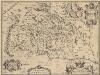
Burgundiae Comitatus. [Karte], in: Theatrum orbis terrarum, S. 153.
1 Karte aus Atlas Ortelius, Abraham Vrients, Jan Baptista
Übersichtskarte von Mittel - Europa

Gouvernements de Bourgogne, Franche Comté et Lyonnois
1 : 4870000 Burgundsko (Francie) Bonne, Rigobert André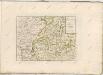

Helvetiae Descriptio
1 : 1200000 Mollova mapová sbírka Tschudi, Ägidius
Illustrations of the Glacier Systems of the Alps and of Glacial Phenomena in general
The physical atlas Johnston, Alexander Keith William Blackwood & Sons
Sabavdiae, et Bvrgvndiae comitatus descriptio
1 Karte : Kupferdruck ; 30 x 21 cm Ortelius; Boileau de Bouillon s.n.
Comitatus Burgundiae [Karte], in: Novus atlas absolutissimus, Bd. 4, S. 230.
1 Karte aus Atlas Janssonius Offizin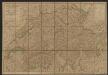
Burgundiae Comitatus, Franche Comté. [Karte], in: Gerardi Mercatoris et I. Hondii Newer Atlas, oder, Grosses Weltbuch, Bd. 2, S. 95.
1 Karte aus Atlas Mercator, Gerhard und Hondius, Jodocus Jansson, Jan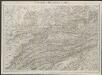
[Burgund] [Karte], in: Gerardi Mercatoris Atlas, sive, Cosmographicae meditationes de fabrica mundi et fabricati figura, S. 258.
1 Karte aus Atlas Mercator, Gerhard Montanus, Petrus
Comitatus sive Liberae Burgundiae nova tabula, vulgo dicta la Franche Comté, divitur tam in praefecturas tres generales, quam in plurimas subalternas
1 : 390000 per F. de Witt Amstelodami : [Frederick de Wit]
Genf, Lyon, Belfort, Macon
1 : 750000 Belfort (Francie) Fendl, J. K. u. k. Militärgeographisches Institut
Genf, Lyon, Belfort, Macon
1 : 750000 Belfort (Francie) K. k. militär-geographisches Institut

Sabavdia
1 : 670000 Savojsko
Fragment de l'Atlas de la Suisse par Tschudi 1538
Tschudi, Aegidius Hofer & Burger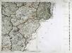
Carte de la France, no. 10
1 Blatt : 61 x 83 cm s.n.
Neue Karte von der Schweiz oder Helvetien in die XIII Eidgenossenschaften, ihre Bundsverwandten und Unterthanen eingetheilt
1 Karte in 2 Bl nach den zuverlässigsten Nachrichten und neuesten astronomischen Beobachtungen, London 1778 bei W. Faden [, neu hrsg. von F.A. Schraembl] Schalbacher, Wien


