Maps of Jura

Lauf des Birs-Flusses von seinem Vrsprung an bis an seinen Ausfluss in den Rhein
1 Karte : Kupferdruck ; 27 x 14 cm Herrliberger; Büchel D. Herrliberger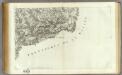
165 Bale.
1 : 86400 Cassini family; Cassini, Cesar-Francois, 1714-1784
Das ehmalige Bisthum Basel
1 : 325000 Basilej-venkov (Švýcarsko : kanton)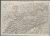
Pruntrut - Solothurn - Basel
1 : 100000 Kriegsdepot des Eidg. Topographischen Bureau's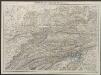
Pruntrut - Solothurn - Basel
1 : 100000 Kriegsdepot des Eidg. Topographischen Bureau's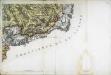
[Bâle]
1 Blatt : 61 x 91 cm Chalmandrier s.n.
TERRITORIVM | BASILEENSE, | cum adjacentibus
[Amsterdam : Joan Blaeu]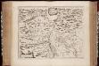
Territorivm Basileense, cum adjacentibus
1 : 140000 Annotatie: Verso UB VU-exemplaar is blanco; Origineel is Blad 115 in atlas factice; Annotatie geografische gegevens: Schaalstok linksonder; Zuid boven Joan Blaeu 1597/98-1673 [Amstelædami, labore & sumptibus : Ioannis Blaev]
Carte de l'ancien évêché de Bâle
1 : 96000 Buchwalder, Antoine Joseph [s.n.]
Die Cantone Solothurn und Basel
1 : 227700 Basilej-venkov (Švýcarsko : kanton) Scheurmenn, J. J.
Wandkarte von Basel und Umgebung
1 : 50000 1 Karte in 4 Teilen bearbeitet von J. Randegger Carl Detloff, Basel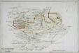
Carte de la prévoté de Moutier Grandval
1 Manuskriptkarte : 30 x 46 cm s.n.
Uebersichtskarte zum Eisenbahnproject Solothurn-Münster
1 : 100000 Eidg. Topogr. Bureau
[Bistum Basel]
1 Karte : Kupferdruck ; 33 x 45 cm s.n.
Canton Solothurn sive pagus Helvetiae Solodurensis cum confinibus
1 : 134500 Solothurn (Švýcarsko : kanton) Walser, Gabriel edentibus Homann. Heredib[us]
Canton Solothurn sive pagus Helvetiae Solodurensis cum confinibus
1 Karte : Kupferdruck ; 23 x 25 cm Walser Homännische Erben
Canton Solothurn sive pagus Helvetiae Solodurensis cum confinibus
1 Karte : Kupferdruck ; 46 x 55 cm Walser Homann. Heredibus
Canton Solothurn sive pagus Helvetiae Solodurensis cum confinibus
1 Karte : Kupferdruck ; 46 x 55 cm Walser Homann. Heredibus
Karte der Kantone Baselland und Baselstadt
1 : 100000 1 Karte von J.S. Gerster ; auf Anordnung der h. Erziehungsdirection von Baselland ; Zeichnung, Stich u. Druck von Wurster, Randegger & Cie. in Winterthur Wurster, Randegger & Cie., Winterthur
Geognostische Karte des Kantons Basel und einiger angrenzenden Gegenden
1 : 150000 Merian, Peter [s.n.]

Carte du canton de Bâle
1 Karte : Kupferdruck ; 32 x 43 cm Clermont; Perrier; Bruckner; Bourgoin Lamy
Atlas novus Reipublicae Helveticae
1 Atlas ([40] Bl., 97 S.) bey Orell, Gessner und Compagnie, Zürich
Der Canton Basel mit den angränzenden Bezirken
1 : 79000 Basilej-oblast (Švýcarsko) Diewald, Johann Nepomuk Bruckner bey Homanns Erben
Pagi Basileensis qui pars est reipublicae Helvetiorum cum adjacentibus terrarum tractibus nova eaque accurata mappa geographica concinnata
1 : 120000 Mollova mapová sbírka Lotter, Tobias Conrad Seutter, Matthäus
Canton Basel sive Pagus Helvetiae Basileensis cum confinibus recenter
1 : 70000 Mollova mapová sbírka Walser, Gabriel Homann, Johann Baptista - dědici
Karte vom Canton Basel
1 : 50000 1 Karte auf 4 Bl. entworfen von Andreas Kündig im Verlag von C. Detloff in Basel ; geologisch aufgenommen u. dargestellt von Albr. Müller in Basel 1862 Wurster & Cie., Winterthur
Carte typométrique du Canton de Basle
1 Karte : Typometrie ; 20 x 19 cm Haas Wilhelm Haas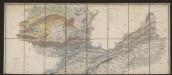
Carte des Cantons Solothurn
1 : 60000 Nordblatt Walker, Josef Engelmann & Compagnie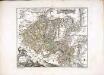
Canton Basel
1 Karte : Kupferdruck ; 43 x 51 cm Bruckner; Büchel; Auvray; Mechel sous les soins de Mr. de Mechel


