Maps of Bas-Rhin

Maps of Bas-Rhin

$title$

Alsatia inferior

1 Karte : Kupferdruck ; 34 x 41 cm Mercator s.n.
$title$

Alsatia inferior

1 Karte : Kupferdruck ; 34 x 42 cm Mercator; Hondius excusum apud Henricum Hondium sub insigno atlantis
$title$

Alsatia inferior

1 Karte : Kupferdruck ; 19 x 29 cm Merian Merian
$title$

Alsatia inferior

1 Karte : Kupferdruck ; 17 x 24 cm Mercator; Keere Cloppenburgh
$title$

Alsatia inferior [Karte], in: Gerardi Mercatoris et I. Hondii Newer Atlas, oder, Grosses Weltbuch, Bd. 1, S. 244.

1 Karte aus Atlas Mercator, Gerhard und Hondius, Jodocus Jansson, Jan
$title$

Alsatia inferior [Karte], in: Gerardi Mercatoris Atlas, sive, Cosmographicae meditationes de fabrica mundi et fabricati figura, S. 365.

1 Karte aus Atlas Mercator, Gerhard Montanus, Petrus
$title$

Alsatia inferior

1 Karte : Kupferdruck ; 35 x 42 cm Hondius; Mercator Jodocus Hondius
$title$

Département du Bas Rhin

1 : 260000 Bas-Rhin (Francie) Houdan, d' P.G. Chanlaire
$title$

$title$

Dept. Du Bas Rhin.

1 : 455000 Levasseur, Victor.
$title$

Département du Bas Rhin

1 Karte : Kupferdruck ; 40 x 35 cm Capitaine s.n.
$title$

Landgraviatus Alsatiae Inferioris Novissima Tabula

1 : 280000 Mollova mapová sbírka Visscher, Nicolaes Jansz. Schenk, Peter II
$title$

Alsatia Inferior

1 : 440000 Mollova mapová sbírka Merian, Matthaeus Merian, Matthäus
$title$

Departement du Bas Rhin

1 Karte : Kupferdruck ; 16 x 15 cm au dépot de l'Atlas national rue de la Monnoye no. 5
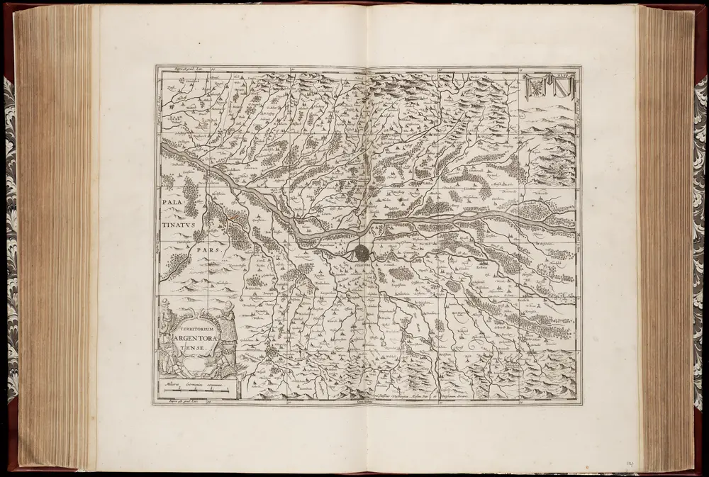
$title$

Landgraviatus Alsatiæ inferioris novissima tabula

1 Karte : Kupferdruck ; 45 x 55 cm Visscher; Schenk nunc apud Petrum Schenk iunior
$title$

Landgraviatus Alsatiae Inferioris novissima tabula, in qua simul Marchionatus Badensis, Ortenavia caeteraque tam Lotharingica quam alia confinia / accuratissimè describuntur per Nicolaum Visscher

1 : 300000 Annotatie: Cum privilegio Ordinum Hollandiæ et Westfrisiæ; Origineel is Blad 113 in atlas factice; Annotatie geografische gegevens: Schaalstokken: Milliaria Germanica communia, en: Milliaria Gallica communia Nicolaes Jansz. Visscher jr. 1649-1702 [Amsterdam : Nicolaus Visscher]
$title$

Vtriusquæ Alsatiæ superioris ac inferioris nova tabvla

1 Karte : Kupferdruck ; 37 x 53 cm Janssonius sumptibus Ioannis Ianssonii
$title$

Alsatia landgraviatus, cum Svntgoia et Brisgoia

1 Karte auf 2 Blättern : Kupferdruck ; 38 x 79 cm Blaeu; Mercator Guiljelm. Blaeu excudit
$title$

ALSATIA | Landgraviatus, | cum | SVNTGOIA | et | BRISGOIA

Ger. Mercatore | Auctore. Guiljelm. Blaeu excudit.
$title$

Département du Bas Rhin

1 Karte : Kupferdruck ; 49 x 48 cm Houdan au bureau de l'atlas national rue de la Harpe no. 26, et au dépot du dit atlas rue de la Monnoye no. 5
$title$

Département du Bas Rhin

1 : 250000 Bas-Rhin (Francie) Chanlaire, Pierre-Grégoire P.G. Chanlaire
$title$

L'Alsace Divisée En Ses Principales Parties.

1 : 250000 Mollova mapová sbírka Jaillot, Alexis-Hubert Jaillot, Alexis Hubert
$title$

Militair Karte von Süd-Deutschland in 20 Sectionen

1 : 400000 9. Section Coulon, Alois von A. von Coulon
$title$

Tribocci

1 Karte : Kupferdruck ; 39 x 49 cm Sanson; Robert de Vaugondy; Somer chés le Sr. Robert geog. du roi quai de l'horloge
$title$

Tribocci

1 : 240000 Mollova mapová sbírka Sanson, Guillaume Mariette, Pierre Sanson, Guillaume
$title$

Alsatia tem Svperior, quam Inferior una cum Svndgovia

1 : 120000 Mollova mapová sbírka Homann, Johann Baptist Homann, Johann Baptista - dědici
$title$

La province d'Alsace divisée en territoires et seigneuries

1 : 165000 Alsasko (Francie) Mayr, Johann
$title$

Partie du Haut Rhein, où se trouvent la Haute et Basse Alsace, Suntgow, Brisgow, Ortenaw, et partie des marquisats de Baden, 1

1 Blatt : 51 x 39 cm de Fer
$title$

Charte von der Grafschaft Hanau-Lichtenberg

1 : 180000 Grattenauer, Ernst C. Grattenauer
$title$

Territorium Argentoriatense. [Karte], in: Novus atlas absolutissimus, Bd. 2, S. 208.

1 Karte aus Atlas Janssonius Offizin
© MapTiler © OpenStreetMap contributors
How does it work?
These instructions will show you how to find historical maps online.
Getting started
Type the place name in the search box to find the exact location. You can further adjust the search by zooming in and out.
Zoom
Zoom in and out with the buttons or use your mouse or touchpad natively.
Exact Area tool
Click here and draw a rectangle over the map to precisely define the search area.
Set filters
Narrow your search with advanced settings, such as Years (from/to), Fulltext, Publisher, etc.
Results
See the results of your search on the right side. You can scroll down to find more maps of this location.
?

Download OldMapsOnline Mobile