Maps of Saintes

Maps of Saintes

$title$

Gowernement de Xaintes

1 Karte : Kupferdruck ; 11 x 15 cm Sebastian Cramoisy
$title$

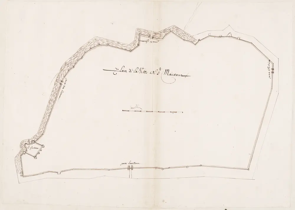
Plan de la ville St. Maixant

[S.l. : s.n.]
$title$

102 Saintes.

1 : 86400 Cassini family; Cassini, Cesar-Francois, 1714-1784
$title$

[Ile d'Oléron]

2 Blätter : zus. 57 x 112 cm s.n.
$title$

Gowerneme[n]t de Broüage

1 Karte : Kupferdruck ; 11 x 15 cm Sebastian Cramoisy
$title$

La Saintonge vers le midy auecq le Brovageais, terre d'Arvert [et]c

1 Karte : Kupferdruck ; 43 x 55 cm Janssonius; Sanson Joannes Janssonius
$title$

Carte dv pais de Xaintonge

1 : 300000 Schenk, Pieter venundantur per Gerardum Valk, et Petrum Schenk
$title$

La Saintonge vers le midy auecq le Brovageais, terre d'Arvert [et]c

1 Karte : Kupferdruck ; 43 x 55 cm Valck; Sanson; Schenk apud G. Valk et P. Schenk
$title$

Carte dv pais de Xaintonge

1 Karte : Kupferdruck ; 35 x 48 cm Valck; Schenk venundantur per Gerardum Valk et Petrum Schenk
$title$

Carte dv pais de Xaintonge

1 Karte : Kupferdruck ; 35 x 48 cm Mercator; Hondius; Hondius excusum apud Iudocum et Henricum Hondium
$title$

Xaintonge

1 Karte : Kupferdruck ; 17 x 24 cm Mercator; Keere Cloppenburgh
$title$

La Saintonge vers le Septentrion avecq Le Pays d' Aulnis et les Isles de Ré et Oleron. [Karte], in: Novus atlas absolutissimus, Bd. 4, S. 147.

1 Karte aus Atlas Janssonius Offizin
$title$

La Saintonge uers le septentrion auecq le pays d'Aulnis et les isles de Ré et Oleron

1 Karte : Kupferdruck ; 43 x 54 cm Janssonius; Sanson Joannes Janssonius
$title$

Xaintonge et Angovmois

1 Karte : Kupferdruck ; 37 x 49 cm Blaeu apud Guiljelmum Blaeu
$title$

La Saintonge vers le Midy: Avecq Le Brouageais, Terre d'Arvert &c. [Karte], in: Novus atlas absolutissimus, Bd. 4, S. 150.

1 Karte aus Atlas Janssonius Offizin
$title$

XAINTONGE, | avec | LE PAYS D'AVLNIS, | LE BROVAGEAIS, | TERRE D'ARVERT, | &c.

[Amsterdam : Joan Blaeu]
$title$

Carte du pais de Xaintonge

1 : 237600
$title$

Dept. De La Charente Infre.

1 : 566000 Levasseur, Victor.
$title$

Département de la Charente inférieure

1 Karte : Kupferdruck ; 56 x 49 cm Houdan au bureau de l'atlas national rue de la Harpe n.o 26
$title$

$title$

Xaintonge et Angoumois. [Karte], in: Theatrum orbis terrarum, sive, Atlas novus, Bd. 2, S. 119.

1 Karte aus Atlas Blaeu, Joan Blaeu, Willem Janszoon
$title$

Xaintonge et Angoumois. [Karte], in: Le théâtre du monde, ou, Nouvel atlas contenant les chartes et descriptions de tous les païs de la terre, Bd. 2, S. 131.

1 Karte aus Atlas Blaeu, Willem Janszoon und Blaeu, Joan Blaeu, Willem Janszoon
$title$

Xaintonge et Angoumots. [Karte], in: Novus Atlas, das ist, Weltbeschreibung, Bd. 2, S. 130.

1 Karte aus Atlas Blaeu, Joan Blaeu, Willem Janszoon
$title$

$title$

$title$

Gouvernement de Saintonge et Angoumois

1 Karte : Kupferdruck ; 31 x 41 cm Mentelle; Tardieu Mentelle
$title$

$title$

Carte Du Pais De Xaintonge [Karte], in: Gerardi Mercatoris et I. Hondii Newer Atlas, oder, Grosses Weltbuch, Bd. 2, S. 115.

1 Karte aus Atlas Mercator, Gerhard und Hondius, Jodocus Jansson, Jan
$title$

Composite 11: Carte de France.

1 : 86400 Cassini family; Cassini, Cesar-Francois, 1714-1784
$title$

Carte des isles de Ré et d'Olleron

1 Karte : Kupferdruck ; 70 x 55 cm Bellin s.n.
© MapTiler © OpenStreetMap contributors
How does it work?
These instructions will show you how to find historical maps online.
Getting started
Type the place name in the search box to find the exact location. You can further adjust the search by zooming in and out.
Zoom
Zoom in and out with the buttons or use your mouse or touchpad natively.
Exact Area tool
Click here and draw a rectangle over the map to precisely define the search area.
Set filters
Narrow your search with advanced settings, such as Years (from/to), Fulltext, Publisher, etc.
Results
See the results of your search on the right side. You can scroll down to find more maps of this location.
?

Download OldMapsOnline Mobile