Maps of Grampian Mountains

A general map of Scotland and islands thereto belonging, 4
1 Blatt : 92 x 62 cm s.n.
Scotland SE.
1 : 486830 Stanford, Edward
Scotiae Provintiae; Inter Taum Fluvium et Septentrionales oras Angliae. [Karte], in: Novus atlas absolutissimus, Bd. 8, S. 160.
1 Karte aus Atlas Janssonius Offizin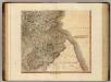
Scotland SE.
1 : 500000 Cary, John, ca. 1754-1835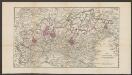
Northumbria, Cumberlandia, Et Dunelmensis Episcopatus. [Karte], in: Atlas, sive, Cosmographicae meditationes de fabrica mundi et fabricati figura, S. 110.
1 Karte aus Atlas Mercator, Gerhard
Northumbria, Cumberlandia, Et Dunelmensis Episcopatus. [Karte], in: Gerardi Mercatoris Atlas, sive, Cosmographicae meditationes de fabrica mundi et fabricati figura, S. 112.
1 Karte aus Atlas Mercator, Gerhard Montanus, Petrus
Scotland[Motoring Map of]
London : "Geographia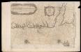
De Custen van Engelandt en Schotlandt tusschen Tinbij en Donde.
Blaeu, Willem Janszoon, 1571-1638
Carte des environs d'Edenburg
1 Karte : Kupferdruck ; 45 x 57 cm Robert de Vaugondy; Arrivet; Fortin; Dussy; Dorret chez le Sr. Fortin ing.r mécanicien du roy rue de la harpe près la rue du Foin

Scotland / J. Ainslie, 9
1 Blatt : 67 x 58 cm Ainslie, Faden
delineation of the strata of England and Wales, with part of Scotland
1 : 320000 Blatt 2 Smith, William Cary
A chart of part of the South of Scotland, from Berwick upon Tweed to Skateraw Harbour in the County of Kincardine...
Ainslie, John, 1745-1828
A chart of part of the South of Scotland, from Berwick upon Tweed to Skateraw Harbour in the County of Kincardine...
Ainslie, John, 1745-1828
A chart of part of the South of Scotland, from Berwick upon Tweed to Skateraw Harbour in the County of Kincardine...
Ainslie, John, 1745-1828
A chart of part of the South of Scotland, from Berwick upon Tweed to Skateraw Harbour in the County of Kincardine...
Ainslie, John, 1745-1828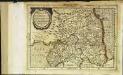
Northvmbria, Cvmberlandia, et Dvnelmensis episcopatus
1 Karte : Kupferdruck ; 17 x 24 cm Mercator; Keere Cloppenburgh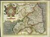
Northvmbria, Cvmberlandia, et Dvnelmensis episcopatus
1 Karte : Kupferdruck ; 33 x 45 cm Mercator; Hondius Henricus Hondius
Northvmbria, Cvmberlandia, et Dvnelmensis episcopatus
1 Karte : Kupferdruck ; 33 x 45 cm Mercator; Hondius Jodocus Hondius
England and Wales 1:253,440
Ordnance Survey
Sheet 1 The Border, uit: Maps of England & Wales : scale 4 miles to 1 inch / Ordnance Survey
1 : 253440 titelvariant: Maps of England and Wales; Annotatie: Titel op cassette; Met bladoverzicht op de achterzijde van de cassette; Annotatie geografische gegevens: Hoogtelijneninterval 200 ft Ordnance Survey, United Kingdom Southampton : Ordnance Survey Office
Northumbria, Cumberlandia, et Dunelmensis Episcopatus
1 : 396000
Nieuwe en seer perfecte paskaart van Schotlandt ... van Berwyk tot Bokannais = A new and pertinent map of the eastern sea-coasts of Scotland ... from the cost of Berwik till Bokaness / by John Marr of
Marr, John, fl. 1660-1720
Beschrijvinge van een deel vann Schottlandt van Bambourg tot Aberdein : daer Edenburg de princepaele Coepstat in is, So hem tlant daer 'bthoont, beneffens 2 eÿlende / door Lucas Ianss Wagenaer ; Ioann
Waghenaer, Lucas Janszoon, 1534 or 5-1606
Comitatus Northumbria vernacule Northumberland. [Karte], in: Novus atlas absolutissimus, Bd. 8, S. 89.
1 Karte aus Atlas Janssonius Offizin
Comitatus Northumbria Vernacule Northumberland. [Karte], in: Theatrum orbis terrarum, sive, Atlas novus, Bd. 4, S. 505.
1 Karte aus Atlas Blaeu, Joan Blaeu, Willem Janszoon
Nordsee
1 : 150000 Severní moře Reichs-Marine-Amt
Comitatus Northumbria Vernacule Northumberland. [Karte], in: Theatrum orbis terrarum, sive, Atlas novus, Bd. 4, S. 505.
1 Karte aus Atlas Blaeu, Joan Blaeu, Willem Janszoon
Comitatus Northumbria; Vernacule Northumberland. [Karte], in: Le théâtre du monde, ou, Nouvel atlas contenant les chartes et descriptions de tous les païs de la terre, Bd. 4, S. 431.
1 Karte aus Atlas Blaeu, Willem Janszoon und Blaeu, Joan Blaeu, Willem Janszoon


