Maps of South West England

Parte meridionale dell' Inghilterra, e del principato di Galles
1 Karte : Kupferdruck ; 29 x 40 cm Zatta; Zuliani; Pitteri presso Antonio Zatta
Partie meridionale de l'Angleterre
1 Karte : Kupferdruck ; 53 x 84 cm s.n.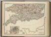
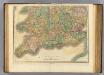
England and Wales (southern sheet).
1 : 887000 Johnston, W. & A.K.
England and Wales.
1 : 1420000 Hammond, C.S.
Galliæ antiquæ descriptio geographica, 1
1 Blatt : 44 x 57 cm s.n.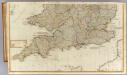
(England, Wales, south)
1 : 575000 Kitchin, Thomas; Phillips, J.; Robert Laurie & James Whittle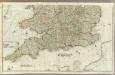
England and Wales (Southern section)
1 : 675000 Rocque, John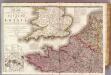
France 1.
1 : 1170000 Herisson, Eustache, b. 1759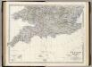
England, Wales S.
1 : 887000 Johnston, Alexander Keith, 1804-1871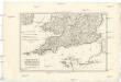
Royaume d'Angleterre
1 : 1950000 Anglie jižní Bonne, Rigobert
Canalis inter Angliæ et Galliæ littora
1 Karte : Kupferdruck ; 48 x 55 cm Renard gedruckt by L. Renard
Pas caart van de canaal tusschen Engeland en Vrancrijck
1 Karte : Kupferdruck ; 43 x 53 cm Doncker by Hendrick Doncker boeckverkoper en graedbooghmaecker inde Nieuwbrugsteegh in 't Stuurmans gereedschap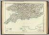
England and Wales (southern sheet).
1 : 887000 Johnston, Alexander Keith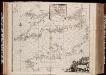
Pascaert van 't Canaal tusschen Engeland en Vranckryck
1 : 1150000 Annotatie: Oorspr. verschenen in: Zee atlas. - 't Amsterdam : by Jacobus Robyn, 1683; Origineel is Blad 25 in atlas factice [Amsterdam : gedruckt bij J. Robijn]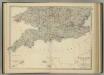
England and Wales (southern sheet).
1 : 887000 Johnston, Alexander Keith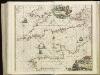
[130][133] Pascaert van 't Canaal tusschen Engeland en Vranckryck, uit: Atlas sive Descriptio terrarum orbis
Annotatie: Gedigitaliseerde versie. Amsterdam. Heiloo : Picturae (vervaardiger), 2015. tiff-bestand. Gedigitaliseerd: 07-01-2015; Origineel: Universiteitsbibliotheek Vrije Universiteit (XL.05127.-) ; Netherlands; Titelpagina ontbreekt Wit, Frederik de Amsterdam : Frederick de Wit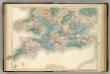
England and Wales.
1 : 900000 Hughes, William
Manica, gallis la Manche, et belgis het Canaal, pars oceani inter Angliam et Gallicam
1 Karte : Kupferdruck ; 46 x 55 cm Visscher; Gouwen Nicolaes Visscher
Carte de l'Angleterre au tems des conquétes des Romains
1 Karte : Kupferdruck ; 23 x 22 cm s.n.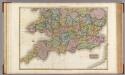
England, southern part.
1 : 755000 Pinkerton, John, 1758-1826
La Manche
1 Karte : Kupferdruck ; 50 x 61 cm Jefferys; Le Rouge chez Le Rouge géographe du roi rue des g.ds Augustins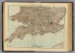
England, Wales S.
1 : 1000000 Andree, Richard; Times (London, England)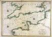
Carte de la Manche
1 Karte : Kupferdruck ; 56 x 79 cm Jaillot; Sanson chez Hubert Jaillot
Anglesey; Wight Vectis olim ; Garnesay ; Iarsay
1 : 1
Carte de la Manche
1 Karte : Kupferdruck ; 50 x 66 cm Lattré chéz Lattré graveur ordinaire du roi de M. le duc d'Orléans et de la ville rue St. Jacques la porte cochère en face de la rue de la Parcheminerie
Carte De La Manche. [Karte], in: Atlas nouveau, contenant toutes les parties du monde [...], Bd. 1, S. 53.
1 Karte aus Atlas Sanson, Nicolas Jaillot, Alexis Hubert und Mortier, Pieter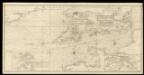
An exact trigonometrical survey of the British Channel, including the mouth of the Thames and Part of the German sea with the coast of Irland from Carnsore point to the Shannon Mouth
Laurie & Whittle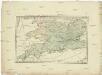
Postkarte von Süd England
Anglie jižní Ponheimer, Kilian im von Reillyschen Landkarten und Kunstwerke Verschleiss Komptoir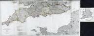
Partie meridionale de la Grande Bretagne, 2
6 Blätter : 48 x 107 cm T. Jeffereys