Maps of Hauts-de-France
Anciens royaumes de Kent, d'Essex, et de Sussex
1 Karte : Kupferdruck ; 36 x 47 cm Sanson chez l'auteur pres de S. Germain l'Auxerrois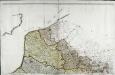
Carte de la France, no. 1
1 Blatt : 60 x 92 cm s.n.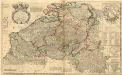
Les Provinces des Pays-Bas Catholiques ou a Most Exact Map of Flanders or Austrian Netherlands &c.
1 : 440000 Mollova mapová sbírka Moll, Herman Bowles, I.
Comitatus Flandriae in omnes ejusdem subjacentes ditio[n]es cum adjacentibus acuratißime divisus
1 : 300000 Flandry Homann, Johann Baptist sumtibus Ioh. Bapt. Homanni
Comitatus Flandriae in omnes ejusdem subjacentes ditio[n]es cum adjacentibus acuratißime divisus
1 : 300000 Flandry Homann, Johann Baptist Ioh. Bapt. Homanni
Comitatus Flandriae in omnes ejusdem subjacentes ditio[n]es cum adjacentibus acuratißime divisus
1 : 300000 Flandry Homann, Johann Baptist sumtibus Ioh. Bapt. Homanni
BELGII VETERIS TYPUS
1 : 1400000 Belgie Ortelius, Abraham Hondius, Henricus C.I. Visscher excudebat
Belgii veteris typvs
Belgie Ortelius, Abraham Abraham Ortelius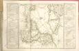
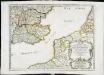
Reliefkarte des Kanals von Cherbourg bis zur Scheldemündung mit Südost - England und Nordfrankreich

Charte von England und Wallis, 4
1 Blatt : 62 x 53 cm Walch
Karte von England und Wallis, 4
1 Blatt : 62 x 53 cm Schrämbl
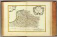
Flandre francoise, Artois, Picardie, Boulenois.
1 : 930000 Bonne, Rigobert, 1727-1794
La plus grande partie de la Manche
1 Karte : Kupferdruck ; 47 x 55 cm Lotter aux depens de Tob: Conr: Lotter geogr
La plus grande partie de la Manche
1 Karte : Kupferdruck ; 48 x 56 cm Seutter aux depens de Matthieu Seutter
La plus grande partie de la Manche
1 Karte : Kupferdruck ; 45 x 58 cm Ottens; Ottens chez R. et J. Ottens

Carte des environs de Londres
1 Karte : Kupferdruck ; 48 x 66 cm Robert de Vaugondy; Arrivet; Fortin; Dussy; Browne chéz le Sr. Fortin ing.r mécanicien du roy rue de la harpe près la rue du Foin
La plus grande partie de La Manche, qui contient les côtes d'Angleterre et celles de France les bords maritimes de Picardie
1 : 650000 Anglie Lotter, Tobias Conrad Tob. Conr. Lotter
Carte des gouvernements de Flandre françoise, d'Artois, de Picardie et du Boulenois
1 Karte : Kupferdruck ; 42 x 55 cm Bonne; Santini; Remondini chez Mr. Remondini
Le Gouvernement General De Picardie, ou sont Le Pays Reconquis, Le Boulenois, Le Ponthieu [...] [Karte], in: Atlas nouveau, contenant toutes les parties du monde [...], Bd. 1, S. 112.
1 Karte aus Atlas Sanson, Nicolas Jaillot, Alexis Hubert und Mortier, Pieter
Carte generale de Picardie
1 Karte : Kupferdruck ; 25 x 35 cm Merian Caspar Merian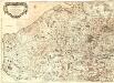
Les Frontieres de France et des Pais Bas
Mollova mapová sbírka Fer, Nicolas de Starckman, P. Danet, Guillaume
Warwicum, Northamtonia, Huntingdonia, Cantabrigia, Suffolcia, Oxonium, Buckinghamia, Bedfordia, Hartfordia, Essexia, Berceria, Middelsexia, Southa[m]tonia, Surria, Cantiu[m] & Southsexia
1 : 815000
Il governi della Fiandra francese, d'Artois, di Picardia, e del Boulonois
1 Karte : Kupferdruck ; 28 x 36 cm Zatta presso Antonio Zatta
Flandria Et Zeelandia Comitatus. [Karte], in: Novus Atlas, das ist, Weltbeschreibung, Bd. 1, S. 354.
1 Karte aus Atlas Blaeu, Joan Blaeu, Willem Janszoon
Flandria Et Zeelandia Comitatus. [Karte], in: Le théâtre du monde, ou, Nouvel atlas contenant les chartes et descriptions de tous les païs de la terre, Bd. 1, S. 383.
1 Karte aus Atlas Blaeu, Willem Janszoon und Blaeu, Joan Blaeu, Willem Janszoon
Karte vom Kriegestheater der vereinigten preussischen und östreichischen Armeen in Frankreich in VI. Blättern, [Blatt 1, 2 und 4]
3 Teile auf 3 Blättern : 72 x 38 cm Königl. preuss. Akademische Kunst- und Buchhandlung


