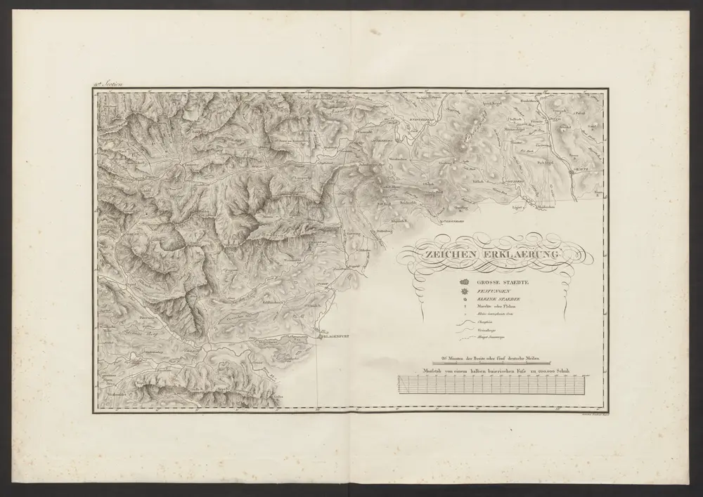
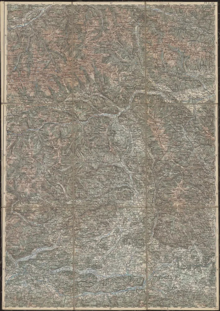
Maps of Styria

Maps of Styria

$title$

Stiria

1 Karte : Kupferdruck ; 29 x 40 cm Mercator; Hondius Henricus Hondius
$title$

Stiria

1 Karte : Kupferdruck ; 29 x 40 cm Mercator s.n.
$title$

STIRIA | Steyrmarck.

Apud Guiljelmum Blaeuw. | Amsterdami.
$title$

Stiria Steyrmarck. [Karte], in: Theatrum orbis terrarum, sive, Atlas novus, Bd. 1, S. 130.

1 Karte aus Atlas Blaeu, Joan Blaeu, Willem Janszoon
$title$

Stiria [Karte], in: Novus atlas absolutissimus, Bd. 2, S. 282.

1 Karte aus Atlas Janssonius Offizin
$title$

Stiria Steyrmarck. [Karte], in: Novus Atlas, das ist, Weltbeschreibung, Bd. 1, S. 213.

1 Karte aus Atlas Blaeu, Joan Blaeu, Willem Janszoon
$title$

Stiria Steyrmarck. [Karte], in: Le théâtre du monde, ou, Nouvel atlas contenant les chartes et descriptions de tous les païs de la terre, Bd. 1, S. 242.

1 Karte aus Atlas Blaeu, Willem Janszoon und Blaeu, Joan Blaeu, Willem Janszoon
$title$

Stiria [Karte], in: Gerardi Mercatoris et I. Hondii Newer Atlas, oder, Grosses Weltbuch, Bd. 1, S. 349.

1 Karte aus Atlas Mercator, Gerhard und Hondius, Jodocus Jansson, Jan
$title$

Stiria [Karte], in: Gerardi Mercatoris Atlas, sive, Cosmographicae meditationes de fabrica mundi et fabricati figura, S. 475.

1 Karte aus Atlas Mercator, Gerhard Montanus, Petrus
$title$

$title$

Charte von Innerösterreich oder den vereinigten Herzogthümern Steyermark und Kaernten

1 : 725000 Korutansko (Rakousko) im Kunst und Industrie Comptoir
$title$

Ducatus Stiriae Novissima Tabula

1 : 470000 Mollova mapová sbírka Vischer, Georg Matthaeus Homann, Johann Baptista - dědici
$title$

Stiria ducatus

1 : 505700 Rakousko Lotter, Tobias Conrad per Tob. Conrad Lotter
$title$

Stiria ducatus

1 : 505700 Rakousko Lotter, Tobias Conrad per Tob. Conrad Lotter
$title$

Stiria ducatus

1 : 505700 Štýrsko (Rakousko) Lotter, Tobias Conrad per Tob. Conrad Lotter
$title$

$title$

Der Noerdliche Theil von Untersteyermark oder der Graetzer Kreis

1 : 260000 Rakousko Kindermann, Joseph Karl Junker, Christoph bey Franz Xaver Miller
$title$

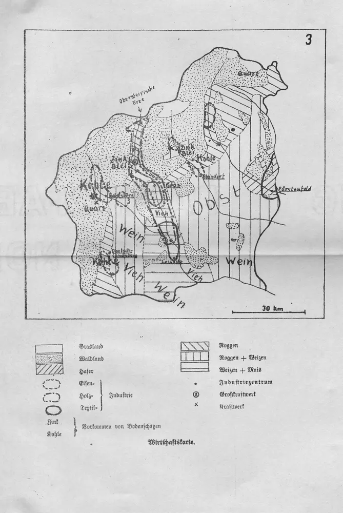
Wirtschaftskarte

Mittelsteiermark Wirtschaft
$title$

Handkarte des Herzogthumes Steiermark

1 : 750000 Štýrsko (Rakousko) Schober, Karl k. u. k. milit.-geograph. Institut
$title$

Specialkarte zu den Manövern des 3. Corps 1891

1 : 75000 K.u.k militär-geographisches Institut
$title$

Generalkarte zu den Manövern des 3. Corps 1891

1 : 300000 Lublaň (Slovinsko : oblast)
$title$

General-Karte des Herzogthums Steyermark

1 : 288000 Oltenie (Rumunsko) Schönfelder, E. von C. J. Wawra Kunst und Landkartenhandlung
$title$

Der noerdliche Theil von Untersteyermark oder der Graetzer Kreis

1 : 250000 Dolní Rakousko (Rakousko) Kindermann, Joseph Karl Junker, Christoph Franz Xaver Miller
$title$

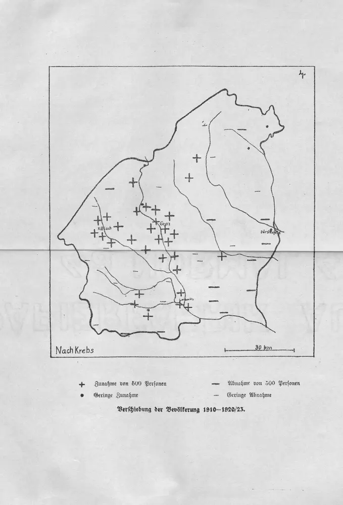
Verschiebung der Bevölkerung 1910-1920/23

Mittelsteiermark Bevölkerungsentwicklung
$title$

Lutzelfrau und Pudelmutter in der Oststeiermark und im Burgenland

Steiermark, Burgenland, Volkskunde Umschaden, Kurt ; Neunteufl, Walter
$title$

$title$

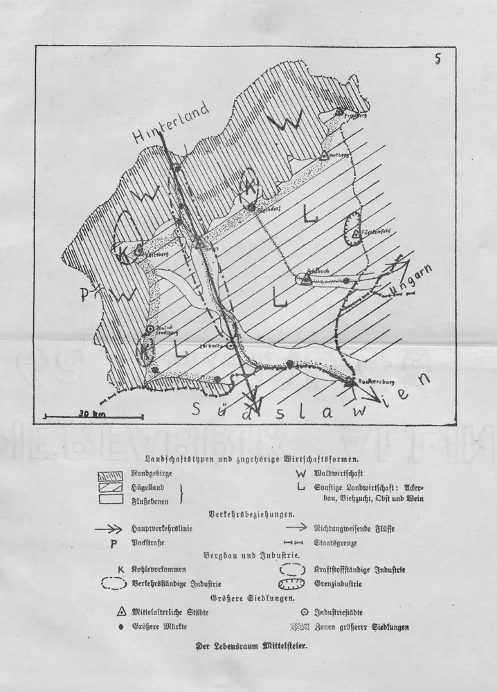
Landschaftstypen und zugehörige Wirtschaftsformen

Mittelsteiermark Landschaftsgliederung, Wirtschaft
$title$

Der nœrdliche Theil von Untersteyermark oder der Grætzer Kreis

1 Karte : Kupferdruck ; 46 x 50 cm Kindermann; Miller; Junker verlegt bey Franz Xaver Miller Buchhændlern
$title$

Karte der Steierischen Alpen und der Karawanken

1 : 250000 Karavanky (Rakousko a Slovinsko : pohoří) Ravenstein, Ludwig Ludwig Ravenstein
$title$

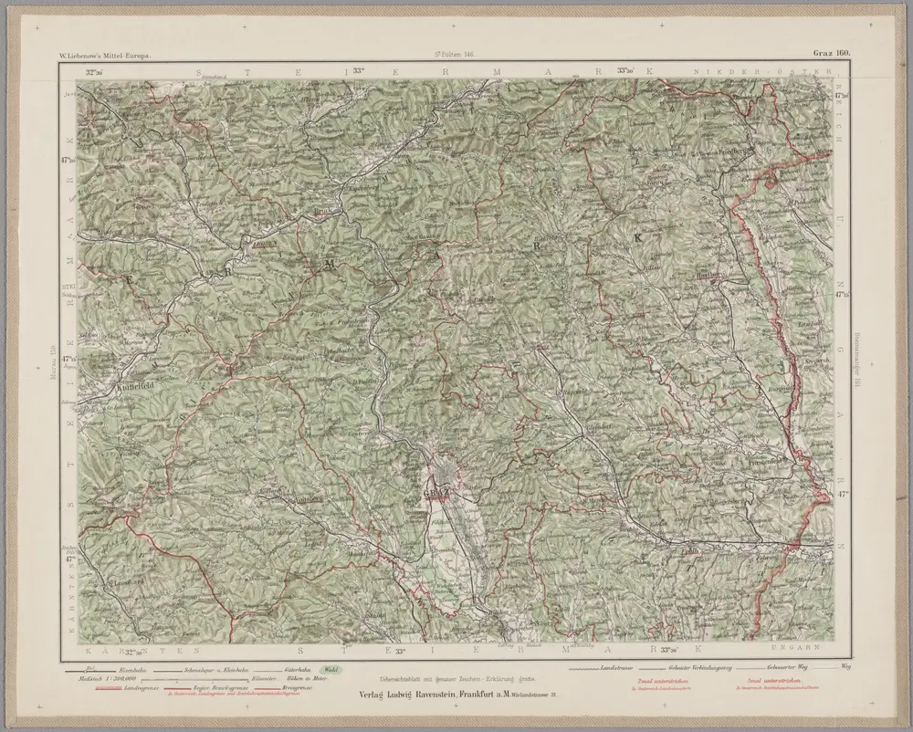
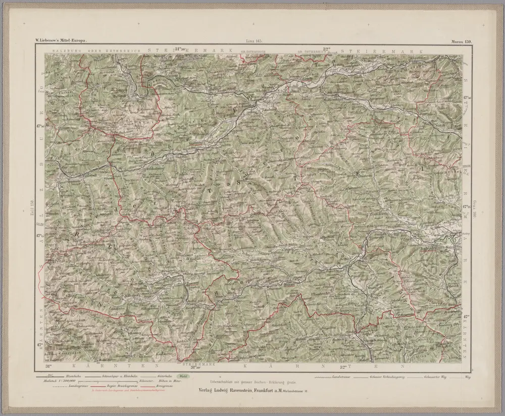
Graz 160, uit: Special-Karte von Mittel-Europa / nach amtlichen Quellen bearbeitet von W. Liebenow

1 : 300000 titelvariant: W. Liebenow's Mittel-Europa; Annotatie: Titel boven de bladen: W. Liebenow's Mittel-Europa Johannes Wilhelm Liebenow 1822-1897 Frankfurt a. M. : Ludwig Ravenstein
© MapTiler © OpenStreetMap contributors
How does it work?
These instructions will show you how to find historical maps online.
Getting started
Type the place name in the search box to find the exact location. You can further adjust the search by zooming in and out.
Zoom
Zoom in and out with the buttons or use your mouse or touchpad natively.
Exact Area tool
Click here and draw a rectangle over the map to precisely define the search area.
Set filters
Narrow your search with advanced settings, such as Years (from/to), Fulltext, Publisher, etc.
Results
See the results of your search on the right side. You can scroll down to find more maps of this location.
?

Download OldMapsOnline Mobile