Maps of Lehndorf-Watenbüttel

Braunschweig nebst Umgegend
Schenk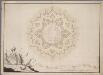
Plan d'un hexagone regulier, fortifié selon la methode dont on s'est servi pour la fortification de la ville de Brounsuic / par H.B. Counradi
1 : 10000 Annotatie: Met 2 profielen Counradi, H.B. [S.l. : s.n.]
Braunschweig

Herzogthum Braunschweig
Grosser Hand-Atlas über alle Theile der Erde in 170 Karten Meyer, J. Verlag des Bibliographischen Instituts
Braunschweig mit der Promenade und den daranstossenden Gärten
Schenk
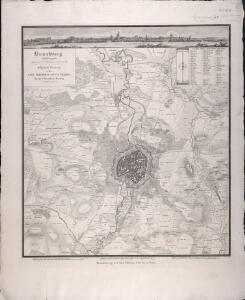
PLAN der Stadt BRAUNSCHWEIG
1 : 3800 Braunschweig (Německo)
Plan der Stadt Braunschweig
1 : 3800 Braunschweig (Německo)
Meßtischblatt 2026 : Braunschweig, 1926
1 : 250000 Braunschweig. - Aufn. 1899, bericht. 1924, kl. Nachtr. 1926. - 1:25000. - [Berlin]: Reichsamt für Landesaufnahme, 1926. - 1 Kt.
Meßtischblatt 2026 : Braunschweig, 1900
1 : 250000 Braunschweig. - Aufn. 1899, hrsg. 1900. - 1:25000. - [Berlin]: Reichsamt für Landesaufnahme, 1900. - 1 Kt.
Meßtischblatt 2025 : Vechelde, 1926
1 : 250000 Vechelde. - Aufn. 1899, Nachtr. 1926. - 1:25000. - [Berlin]: Reichsamt für Landesaufnahme, 1926. - 1 Kt.
Composite: 288. Braunschweig.
1 : 100000 Reichsamt fur Landesaufnahme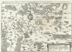
Eigentlicher grundt-riß, abbildung und Situation der Fürstl: Residentz und Haupt vestung Wolfenbüttel und der Stat Braunschweig, samt umbliegender gegent
1 : 130000 Mollova mapová sbírka Buno, Konrad Merian, Matthäus - dědici
Meßtischblatt 1959 : Meine, 1937
1 : 250000 Meine. - Hrsg. 1901, bericht. 1934, einz. Nachtr. 1936, mehrfarb. Ausg. 1937. - 1:25000. - [Berlin]: Reichsamt für Landesaufnahme, 1937. - 1 Kt.
Meßtischblatt 1959 : Meine, 1901
1 : 250000 Meine. - Aufn. 1899. - 1:25000. - [Berlin]: Reichsamt für Landesaufnahme, 1901. - 1 Kt.
Meßtischblatt 3629 : Plobsheim, 1885
1 : 250000 Plobsheim. - Aufn. 1883. - 1:25000. - [Berlin]: Reichsamt für Landesaufnahme, 1885. - 1 Kt.
Meßtischblatt 1958 : Wendeburg, 1937
1 : 250000 Wendeburg. - [Aufn. 1896], hrsg. 1901, bericht. 1934, einzelne Nachtr. 1936, mehrfarb. Ausg. 1937. - 1:25000. - [Berlin]: Reichsamt für Landesaufnahme, 1937. - 1 Kt.
Meßtischblatt 1958 : Wendeburg, 1924
1 : 250000 Wendeburg. - Aufn. 1899, bericht. 1924. - 1:25000. - [Berlin]: Reichsamt für Landesaufnahme, 1924. - 1 Kt.
Meßtischblatt 3628 : Erstein, 1884
1 : 250000 Erstein. - Aufn. 1883. - 1:25000. - [Berlin]: Reichsamt für Landesaufnahme, 1884. - 1 Kt.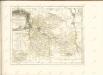

87. Braunschweig, uit: Topographische Uebersichtskarte des Deutschen Reiches / herausgegeben v. d. Kartogr. Abt. d. Königl. Preuß. Landesaufnahme
1 : 200000 titelvariant: Topogr. Übersichtskarte des Deutschen Reiches; Annotatie: Titel boven bladen ook: Topogr. Übersichtskarte des Deutschen Reiches; Annotatie geografische gegevens: Op elk blad twee maatstokken: 10 Kilometer = 5,5 cm; 1 geogr. Meile = 3,6 cm; Legenda onder op elk blad Königlich Preußische Landesaufnahme. Kartographische Abtheilung [S.l : Königlich Preußische Landesaufnahme, Kartographische Abtheilung]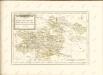

Hannover 58, uit: [W. Liebenow's Special-Karte von Mittel-Europa]
1 : 300000 titelvariant: W. Liebenow's Mittel-Europa; Annotatie: Titel boven de bladen: W. Liebenow's Mittel-Europa Johannes Wilhelm Liebenow 1822-1897 Hannover : Hermann Oppermann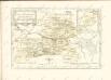

Hannover 58, uit: Special-Karte von Mittel-Europa / nach amtlichen Quellen bearbeitet von W. Liebenow
1 : 300000 titelvariant: W. Liebenow's Mittel-Europa; Annotatie: Titel boven de bladen: W. Liebenow's Mittel-Europa Johannes Wilhelm Liebenow 1822-1897 Frankfurt a. M. : Ludwig Ravenstein
Episcopatvs Hildesiensis descriptio novissima
1 : 317000 Hildesheim (Německo) Gigas, Johann Michael Ioanne Gigante
Episcopatvs Hildesiensis descriptio novissima
1 : 320000 Mollova mapová sbírka Gigas, Johann Michael Schenk, Peter I
Episcopatvs Hildesiensis descriptio novissima
1 : 320000 Mollova mapová sbírka Gigas, Johann Michael Janssonius, Johannes I
Episcopatvs Hildesiensis descriptio novissima
1 : 440000 Mollova mapová sbírka Merian, Matthaeus Merian, Matthäus - dědici
EPISCOPATVS | HILDESIENSIS | DESCRIPTIO NOVISSIMA
Authore Ioanne Gigante D. Med. et Math. [Amsterdam : Joan Blaeu]