Project
Community
News
My maps
Cataloged map
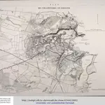
Plan des Schlachtfeldes von Schleswig
Full title:
Plan des Schlachtfeldes von Schleswig
Publisher:
[Schropp]
Physical Size:
20 x 30 cm
Map scale:
1:15 000
History